


Ireland
1999
|
Revised edition
Collins (Verlag)
978-0-00-448827-1 (ISBN)
Collins (Verlag)
978-0-00-448827-1 (ISBN)
- Titel erscheint in neuer Auflage
- Artikel merken
Zu diesem Artikel existiert eine Nachauflage
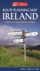
1:550,000 8.7 miles to 1 inch Clear, colourful map of the whole of Ireland ideal as a planning map.
MAIN FEATURES
• Fully revised mapping
• Whole of Ireland at 8.7 miles to 1 inch
• Fully classified road network
• Tourist information centres & offices with addresses and phone numbers
• Town plans of Dublin and Belfast
INCLUDES
• Index to place names
• Attractive hill layer colouring
• Key in English, French and German
• Distance chart
AREA OF COVERAGE
Covers the whole of Ireland
WHO THE PRODUCT IS AIMED AT
Ideal route planning maps for both business user and tourist.
OTHER PRODUCTS IN THE SERIES
• Route Planning Map of Britain
• Route Planning Map of Scotland
| Erscheint lt. Verlag | 6.4.1999 |
|---|---|
| Reihe/Serie | Route Planning Map |
| Zusatzinfo | ch. |
| Verlagsort | London |
| Sprache | englisch |
| Maße | 140 x 236 mm |
| Gewicht | 108 g |
| Themenwelt | Reisen ► Karten / Stadtpläne / Atlanten ► Europa |
| ISBN-10 | 0-00-448827-X / 000448827X |
| ISBN-13 | 978-0-00-448827-1 / 9780004488271 |
| Zustand | Neuware |
| Haben Sie eine Frage zum Produkt? |
Mehr entdecken
aus dem Bereich


aus dem Bereich
Karte (gefalzt) (2023)
Freytag-Berndt und ARTARIA (Verlag)
12,90 €
Straßen- und Freizeitkarte 1:250.000
Karte (gefalzt) (2023)
Freytag-Berndt und ARTARIA (Verlag)
12,90 €
Östersund
Karte (gefalzt) (2023)
Freytag-Berndt und ARTARIA (Verlag)
12,90 €