


Ireland
2000
|
Revised edition
Collins (Verlag)
978-0-00-448992-6 (ISBN)
Collins (Verlag)
978-0-00-448992-6 (ISBN)
- Titel erscheint in neuer Auflage
- Artikel merken
Zu diesem Artikel existiert eine Nachauflage
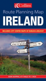
1:550,000 9 miles to 1 inch Clear, colourful map of the whole of Ireland ideal as a planning map.
MAIN FEATURES
• Fully revised mapping for 2002
• Whole of Ireland at 9 miles to 1 inch
• Fully classified road network
• Tourist information centres & offices with addresses and phone numbers
• Town plans of Dublin and Belfast
INCLUDES
• Index to place names
• Attractive hill layer colouring
• Key in English, French and German
• Distance chart
AREA OF COVERAGE
Covers the whole of Ireland
WHO THE PRODUCT IS AIMED AT
Ideal route planning maps for both business user and tourist.
| Erscheint lt. Verlag | 7.2.2000 |
|---|---|
| Reihe/Serie | Route Planning Map |
| Zusatzinfo | Col.M. |
| Verlagsort | London |
| Sprache | englisch |
| Maße | 140 x 240 mm |
| Gewicht | 110 g |
| Themenwelt | Reisen ► Karten / Stadtpläne / Atlanten ► Europa |
| ISBN-10 | 0-00-448992-6 / 0004489926 |
| ISBN-13 | 978-0-00-448992-6 / 9780004489926 |
| Zustand | Neuware |
| Haben Sie eine Frage zum Produkt? |
Mehr entdecken
aus dem Bereich


aus dem Bereich
Straßen- und Freizeitkarte 1:250.000
Karte (gefalzt) (2023)
Freytag-Berndt und ARTARIA (Verlag)
12,90 €
Karte (gefalzt) (2023)
Freytag-Berndt und ARTARIA (Verlag)
12,90 €
Narvik
Karte (gefalzt) (2023)
Freytag-Berndt und ARTARIA (Verlag)
12,90 €