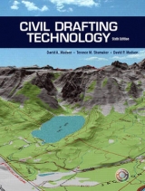
Civil Drafting Technology
Pearson
978-0-13-049879-3 (ISBN)
- Titel erscheint in neuer Auflage
- Artikel merken
This text provides straightforward and comprehensive coverage of civil drafting technology and mapping. It includes survey types, plots, plan and profile, contours, and earthworks. Input and ideas from the industry, specifically civil engineering companies, offers students a well-rounded view of the civil drafting field and the types of drawings and skills associated with it.
1. Introduction to Civil Drafting Technology.
Maps in General. Types of Maps. Civil Engineering Companies. Map Requirements. Cartography. Schooling. Basic Civil Drafting Techniques.
2. Mapping Scales.
Numerical Scale. Graphic Scale. Verbal Scale. Scale Conversion. Civil Engineer's Scale. Metric Scales. CAD Scales.
3. Mapping Symbols.
Types of Symbols. Special Techniques. Drawing Mapping Symbols with CAD.
4. Measuring Distance and Elevation.
Measuring Distance. Measuring Elevation.
5. Surveying Fundamentals.
The Shape and Size of the Earth. Types of Surveys. Traversing. Electronic Traversing. Global Positioning System.
6. Location and Direction.
Location. Direction. Location and Direction on a Quadrangle Map. Map Geometry. Plotting Property Using Latitudes and Departures.
7. Legal Descriptions and Plot Plans.
Metes and Bounds. Lot and Block. Rectangular System. Plot Plans. Methods of Sewage Disposal.
8. Contour Lines.
Contour Line Characteristics. Types of Contour Lines. Plotting Contour Lines from Field Notes. Plotting Contour Lines with a CAD System. Enlarging Contour Maps. Enlarging and Digitizing Contour Maps with a CAD System.
9. Profiles.
Contour Map Profiles. Profile Leveling. Plan and Profile. Plan and Profile with CAD.
10. Highway Layout.
Plan Layout. Plan Layout with a CAD System. Profile Layout. Drawing Conversions for CAD.
11. Earthwork.
Highway Cut-and-Fill Layout. Highway Cut-and-Fill Layout with a CAD System. Cross Sections. Site Plan Cut-and-Fill Layout. Site Plan Cut-and Fill Layout with a CAD System. Earthwork Calculations.
12. Introduction to Geographic Information Systems (GIS).
Introduction to GIS. Related Disciplines. GIS Concepts. GIS Components. Data Formats. GIS Applications. History. Software/Hardware. Third Party Applications. Training. Trends in GIS. Introduction to GPS.
Glossary.
Abbreviations.
Index.
| Erscheint lt. Verlag | 19.6.2003 |
|---|---|
| Sprache | englisch |
| Maße | 211 x 277 mm |
| Gewicht | 670 g |
| Themenwelt | Technik ► Bauwesen |
| ISBN-10 | 0-13-049879-3 / 0130498793 |
| ISBN-13 | 978-0-13-049879-3 / 9780130498793 |
| Zustand | Neuware |
| Haben Sie eine Frage zum Produkt? |
aus dem Bereich


