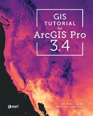
GIS Tutorial for ArcGIS Pro 3.4
ESRI Press (Verlag)
978-1-58948-815-1 (ISBN)
- Noch nicht erschienen (ca. Juli 2025)
- Versandkostenfrei innerhalb Deutschlands
- Auch auf Rechnung
- Verfügbarkeit in der Filiale vor Ort prüfen
- Artikel merken
GIS Tutorial for ArcGIS Pro 3.4 is the book everyone needs to learn the powerful desktop app ArcGIS Pro.
GIS Tutorial for ArcGIS Pro 3.4 is one of the top books on geographic information systems (GIS). Written by award-winning instructors at Carnegie Mellon University, GIS Tutorial for ArcGIS Pro introduces readers, step by step, to basic ArcGIS Pro skills such as:
designing maps
using file geodatabases
geoprocessing
geocoding
creating an online story map or dashboard
working with raster and 3D maps
doing spatial analysis
This resource offers numerous examples and experiences to help cement new concepts and skills. By providing hands-on exercises as well as homework assignments, it allows readers to walk through various concepts step by step and reinforce their skills by integrating them for problem-solving.
For educators looking to adopt this book for their curriculum, more in-depth instruction, video lectures, and written transcripts are available from the authors. Additional instructor resources including PowerPoint slides, grading sheets, and homework answers (available on VitalSource).
This book is easy to use and provides concise explanations; at the same time, it’s rigorously thorough in its explanations and practice of Esri’s desktop GIS technology. Complete with numerous exercises to practice and improve learning, and additional teaching resources for educators, GIS Tutorial for ArcGIS Pro 3.4 is the ideal book for both classrooms and self-learners looking to develop their understanding of and expertise in ArcGIS Pro.
Build your knowledge and use of ArcGIS Pro with GIS Tutorial for ArcGIS Pro 3.4.
Wilpen L. Gorr is emeritus professor of public policy and management information systems at the School of Public Policy and Management, H. John Heinz III College, Carnegie Mellon University, where he taught and researched GIS applications. He was also chairman of the school’s Master of Science in Public Policy and Management program and editor of the International Journal of Forecasting. He lives in Pittsburgh, PA. Kristen S. Kurland is a Teaching Professor of Architecture, Information Systems, and Public Policy at the H. John Heinz III College and School of Architecture, Carnegie Mellon University, where she teaches GIS, building information modeling, computer-aided design, 3D visualization, infrastructure management, and enterprise data analytics. She is the author of GIS Jump Start for Health Professionals (Esri Press, 2022). She resides in Pittsburgh, PA.
Part 1: Using, making, and sharing maps
Chapter 1 Introducing ArcGIS
Chapter 2 Map design
Chapter 3 Maps for end users
Part 2: Working with spatial data
Chapter 4 File geodatabases
Chapter 5 Spatial data
Chapter 6 Geoprocessing
Chapter 7 Digitizing
Chapter 8 Geocding
Part 3: Applying advanced geospatial technologies
Chapter 9 Spatial anallysis
Chapter 10 Raster GIS
Chapter 11 3D GIS
| Erscheint lt. Verlag | 10.7.2025 |
|---|---|
| Zusatzinfo | Illustrations |
| Verlagsort | Redlands |
| Sprache | englisch |
| Maße | 203 x 247 mm |
| Themenwelt | Schulbuch / Wörterbuch ► Lexikon / Chroniken |
| Schulbuch / Wörterbuch ► Unterrichtsvorbereitung ► Unterrichts-Handreichungen | |
| Mathematik / Informatik ► Informatik ► Datenbanken | |
| Informatik ► Software Entwicklung ► User Interfaces (HCI) | |
| Naturwissenschaften ► Geowissenschaften ► Geografie / Kartografie | |
| Sozialwissenschaften ► Pädagogik | |
| Technik | |
| ISBN-10 | 1-58948-815-6 / 1589488156 |
| ISBN-13 | 978-1-58948-815-1 / 9781589488151 |
| Zustand | Neuware |
| Informationen gemäß Produktsicherheitsverordnung (GPSR) | |
| Haben Sie eine Frage zum Produkt? |
aus dem Bereich


