Hadrian's Wall Path
Cicerone Press (Verlag)
978-1-85284-392-2 (ISBN)
- Titel erscheint in neuer Auflage
- Artikel merken
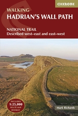
Guidebook for walking along Hadrian's Wall Path between Bowness-on-Solway and Wallsend in Newcastle. The 84 mile National Trail typically takes about a week, and this guide is filled with information on the many sights along the route. Included too is practical advice on accommodation, transport to the start and finish points as well as the author's own sketches, panoramas and maps to guide you. The trail is described in both directions east-to-west and west-to-east.
Mark Richards originally trained in farming, but in more recent years his love of the countryside has been expressed through the creation of illustrated walking guides. He is author of fourteen books, including the first Cicerone guide to walking the length of Hadrian's Wall. He has a particular interest in the Peak District, Cumbria and Hadrian's Wall, and was instrumental in founding the Hadrian's Wall Path Trust.
Stage
1/32 Wallsend - Walker Riverside Park
2/31 Walker Riverside Park - Elswick
3/30 Elswick - Denton Dene
4/29 Denton Dene - Newburn
5/28 Newburn - Heddon-on-the-Wall
6/27 Heddon-on-the-Wall - Harlow Hill
7/26 Harlow Hill - Woodhouses Road-End
8/25 Woodhouses Road-End - Halton Shields
9/24 Halton Shields - The Portgate
10/23 The Portgate - Heavenfield
11/22 Heavenfield - Chollerford
12/21 Chollerford - Tower Tye
13/20 Tower Tye - Carrawburgh
14/19 Carrawburgh - Sewingshields Farm
15/18 Sewingshields Farm - Housesteads
16/17 Housesteads - Steel Rigg
17/16 Steel Rigg - Cawfields Quarry
18/15 Cawfields Quarry - Walltown Crags
19/14 Walltown Crags - Gilsland
20/13 Gilsland - Birdoswald
21/12 Birdoswald - Banks
22/11 Banks - Walton
23/10 Walton - Newtown
24/9 Newtown - Oldwall
25/8 Oldwall - Crosby-on-Eden
26/7 Crosby-on-Eden - Eden Bridge
27/6 Eden Bridge - Grinsdale
28/5 Grinsdale - Beaumont
29/4 Beaumont - Dykesfield
30/3 Dykesfield - Drumburgh
31/2 Drumburgh - Port Carlisle
32/1 Port Carlisle - Bowness-on-Solway
| Erscheint lt. Verlag | 12.12.2013 |
|---|---|
| Zusatzinfo | Over 80 colour photos, 40 line drawings and 32 maps |
| Verlagsort | Kendal |
| Sprache | englisch |
| Maße | 116 x 172 mm |
| Gewicht | 350 g |
| Themenwelt | Sachbuch/Ratgeber ► Sport |
| Reiseführer ► Europa ► Großbritannien | |
| ISBN-10 | 1-85284-392-6 / 1852843926 |
| ISBN-13 | 978-1-85284-392-2 / 9781852843922 |
| Zustand | Neuware |
| Informationen gemäß Produktsicherheitsverordnung (GPSR) | |
| Haben Sie eine Frage zum Produkt? |
aus dem Bereich


