The Thames Path
Cicerone Press (Verlag)
978-1-85284-436-3 (ISBN)
- Titel ist leider vergriffen;
keine Neuauflage - Artikel merken
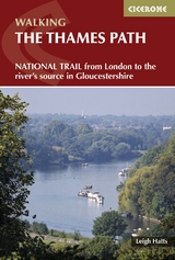
A guidebook to the Thames Path National Trail following the popular route from the Thames Barrier in London to the source of the Thames 180 miles away in rural Gloucestershire. The Thames Path towpath route, opened as a National Trail in 1996, has been improved by the addition of new footbridges and the creation of 20 miles of new riverside path. More than 90% of the Thames Path is either public footpath or bridleway. The Thames, once an important water highway, links a string of historic sites. In the capital there is Greenwich, the Houses of Parliament and Lambeth Palace. Hampton Court Palace lies just outside London, and before reaching Windsor there is riverside Runneymede where King John agreed to the Magna Carta. The water and towpath in the Upper Reaches can be both beautiful and lonely, with cormorants, herons and swans, as appreciated by Shelley and William Morris. The climax is the 22 miles of the infant Thames leading to a field with its often dry spring situated just below the Roman Fosse Way.
Leigh Hatts has been walking the Thames towpath and exploring the river and Docklands since 1981 when he worked on the feasibility study which resulted in the decision to establish the route as a National Trail. The author worked as a reporter with the walkers' magazine 'TGO' and as arts correspondent of the 'Catholic Herald'. He is co-founder of 'Bankside Press' and London's 'In SE1' listings magazine.
The Route
1. Thames Barrier to Tower Bridge (9 miles; 14.5km)
2. Tower Bridge to Putney (10 miles; 16km)
3. Putney to Kingston (13 miles; 20.9km)
4. Kingston to Chertsey (11 miles; 17.7km)
5. Chertsey to Staines (4 miles; 6.4km)
6. Staines to Windsor (71?2 miles; 12km)
7. Windsor to Maidenhead (61?2 miles; 10.5km)
8. Maidenhead to Marlow (7 miles; 11.2km)
9. Marlow to Henley (81?2 miles; 13.6km)
10. Henley to Reading (9 miles; 14.5km)
11. Reading to Pangbourne (7 miles; 11.2km)
12. Pangbourne to Goring (4 miles; 6.4km)
13. Goring to Wallingford (7 miles; 11.2km)
14. Wallingford to Dorchester (5 miles; 8km)
15. Dorchester to Abingdon (9 miles; 14.5km)
16. Abingdon to Oxford (91?2 miles; 15.2km)
17. Oxford to Newbridge (131?2 miles; 21.7km)
18. Newbridge to Lechlade (16 miles; 25.7km)
19. Lechlade to Cricklade (101?2 miles; 16.8km)
20. Cricklade to Source (121?4 miles; 19.7km)
| Erscheint lt. Verlag | 11.2.2013 |
|---|---|
| Zusatzinfo | 60 colour photos and over 30 OS maps |
| Verlagsort | Kendal |
| Sprache | englisch |
| Maße | 116 x 172 mm |
| Gewicht | 270 g |
| Themenwelt | Sachbuch/Ratgeber ► Sport |
| Reiseführer ► Europa ► Großbritannien | |
| ISBN-10 | 1-85284-436-1 / 1852844361 |
| ISBN-13 | 978-1-85284-436-3 / 9781852844363 |
| Zustand | Neuware |
| Haben Sie eine Frage zum Produkt? |
aus dem Bereich