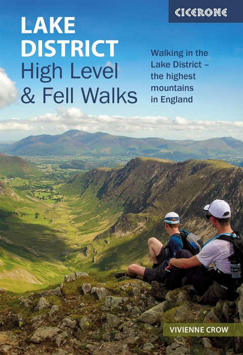
Lake District: High Level and Fell Walks
Cicerone Press (Verlag)
978-1-78631-226-6 (ISBN)
A guidebook to 30 high level day walks in the Lake District, exploring some of the best mountains, ridgewalks, fells and summits within the national park. Mostly circular except for a few linear routes that make use of public transport links, the walks are graded according to difficulty, ensuring there is something for all levels of fitness and experience.
The walks range from 7 to 24km (4–15 miles) in length and can be completed in between 3 and 9 hours. They are arranged geographically into 6 areas: Keswick, Borrowdale and Buttermere, the Western Valleys, Coniston and Langdale, Ambleside and Windermere, and Ullswater.
1:50,000 OS maps for each walk
GPX files available to download
Detailed information on terrain, refreshments and public transport for each walk
Information given on local history and archaeology
Highlights include Scafell Pike, Scafell, Helvellyn, Skiddaw, Newlands Round and the Fairfield Horseshoe
Londoner by birth, but Cumbrian by choice, Vivienne Crow is an award-winning writer and photographer. Based near the Lake District, she has written more than a dozen guides to the national park and writes popular walking columns that appear in several north Cumbrian newspapers.
Introduction
The high fells
Geology
Wildlife and habitats
History
Weather
Where to stay
Getting around
Waymarking and access
Maps
Clothing, equipment and safety
Using this guide
The Walks
Walk 1 Skiddaw via Ullock Pike
Walk 2 Blencathra and its neighbours
Walk 3 Coledale Horseshoe
Walk 4 Newlands Round
Walk 5 Causey Pike, Knott Rigg and Robinson
Walk 6 Helvellyn range, end to end
Walk 7 Scafell Pike
Walk 8 Glaramara and Allen Crags
Walk 9 Great Gable (from Honister)
Walk 10 Hay Stacks
Walk 11 Grasmoor and Gasgale Crags
Walk 12 The High Stile ridge
Walk 13 Great Gable (from Wasdale Head)
Walk 14 Pillar and Red Pike
Walk 15 Scafell
Walk 16 The Coniston Fells
Walk 17 The Langdale Pikes
Walk 18 Pike o' Blisco and Crinkle Crags
Walk 19 Bow Fell and the Mickleden Round
Walk 20 Fairfield Horseshoe
Walk 21 Helm Crag and Blea Rigg
Walk 22 Kentmere Round
Walk 23 Helvellyn via the edges
Walk 24 Deepdale Round
Walk 25 Caiston Glen Round
Walk 26 Hartsop Dodd and Gray Crag
Walk 27 High Street and Harter Fell
Walk 28 A Martindale Round
Walk 29 Place Fell and Beda Fell
Walk 30 Matterdale and the Dodds
Appendices
Appendix A
Route summary table
Appendix B
96
800x600
Normal
0
false
false
false
EN-GB
JA
X-NONE
/* Style Definitions */
table.MsoNormalTable
{mso-style-name:"Table Normal";
mso-tstyle-rowband-size:0;
mso-tstyle-colband-size:0;
mso-style-noshow:yes;
mso-style-priority:99;
mso-style-parent:"";
mso-padding-alt:0cm 5.4pt 0cm 5.4pt;
mso-para-margin:0cm;
mso-para-margin-bottom:.0001pt;
mso-pagination:widow-orphan;
font-size:10.0pt;
font-family:Calibri;}
Useful contacts
| Erscheinungsdatum | 20.02.2024 |
|---|---|
| Reihe/Serie | Cicerone guidebooks |
| Zusatzinfo | 33 maps, 132 colour photographs |
| Verlagsort | Kendal |
| Sprache | englisch |
| Maße | 116 x 172 mm |
| Gewicht | 230 g |
| Themenwelt | Sachbuch/Ratgeber ► Sport |
| Reisen ► Sport- / Aktivreisen ► Europa | |
| ISBN-10 | 1-78631-226-3 / 1786312263 |
| ISBN-13 | 978-1-78631-226-6 / 9781786312266 |
| Zustand | Neuware |
| Haben Sie eine Frage zum Produkt? |
aus dem Bereich
