


The Cotswold Way Map Booklet
Cicerone Press (Verlag)
978-1-78631-211-2 (ISBN)
A guidebook to walking the Cotswold Way National Trail between Chipping Camden and Bath. Covering 163km (102 miles) across the Cotswolds National Landscape this straightforward hike takes 2 weeks to walk.
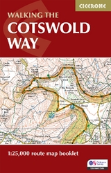
The full route line is shown on 1:25,000 OS maps
The map booklet can be used to walk the trail in either direction
Sized to easily fit in a jacket pocket
The relevant extract from the OS Explorer map legend is included
An accompanying Cicerone guidebook – Walking the Cotswold Way is also available, which includes a copy of this map booklet
Jonathan and Lesley Williams have been directors of Cicerone for 25 years, now partly retired with the next generation of directors firmly established, they now enjoy increased time exploring and researching as authors. Based on the edge of the Lake District, they enjoy spending days in the hills and months in the mountains and have written or updated several Cicerone guidebooks for Switzerland, as well as guidebooks for areas of the UK. Lesley particularly enjoyed revisiting some parts of the Cotswolds, including Crickley Hill, where she briefly helped on the 1972 archaeological dig. Although this is entirely a new guidebook, it owes much to the foundations of previous editions of the Cicerone guide to the Cotswold Way written by Kev Reynolds. Kev Reynolds was a prolific author of guidebooks for Cicerone Press. Although most of his guides were devoted to mountain regions such as the Alps, Pyrenees and Himalaya, he considered the gentler landscapes of the English countryside to be no second best, regarding every day spent among them as a gift to cherish. His passion for mountains in particular and the countryside in general remained undiminished after a lifetime’s activity, until his death in 2021.
Stage 1 Chipping Campden to Broadway Stage 2 Broadway to Stanton Stage 3 Stanton to Winchcombe Stage 4 Winchcombe to Cleeve Hill Stage 5 Cleeve Hill to Dowdeswell Stage 6 Dowdeswell to Birdlip Stage 7 Birdlip to Painswick Stage 9 Painswick to Middleyard (King’s Stanley) Stage 9 Middleyard (King’s Stanley) to Dursley Stage 10 Dursley to Wotton-under-Edge Stage 11 Wotton-under-Edge to Hawkesbury Upton Stage 12 Hawkesbury Upton to Tormarton Stage 13 Tormarton to Cold Ashton Stage 14 Cold Ashton to Bath
| Erscheinungsdatum | 17.02.2024 |
|---|---|
| Reihe/Serie | Cicerone guidebooks |
| Co-Autor | Kev Reynolds |
| Verlagsort | Kendal |
| Sprache | englisch |
| Maße | 106 x 166 mm |
| Gewicht | 60 g |
| Themenwelt | Sachbuch/Ratgeber ► Sport |
| Reisen ► Karten / Stadtpläne / Atlanten ► Europa | |
| ISBN-10 | 1-78631-211-5 / 1786312115 |
| ISBN-13 | 978-1-78631-211-2 / 9781786312112 |
| Zustand | Neuware |
| Haben Sie eine Frage zum Produkt? |


