


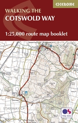
The Cotswold Way Map Booklet
Cicerone Press (Verlag)
978-1-85284-897-2 (ISBN)
- Titel ist leider vergriffen;
keine Neuauflage - Artikel merken
All the mapping you need to complete the Cotswold Way National Trail between Chipping Campden and Bath.
NOTE: An accompanying Cicerone guidebook - The Cotswold Way - describes the full route in both directions with lots of other practical and historical information, for those who prefer a written guide. The accompanying guidebook INCLUDES a copy of this map booklet.
This booklet of Ordnance Survey 1:25,000 Explorer maps has been designed for convenient use on the trail. It shows the full and up-to-date line of the Cotswold Way, along with the relevant extract from the OS Explorer map legend. It is conveniently sized for slipping into a jacket pocket or top of a rucksack.
Kev Reynolds is a freelance writer, photojournalist and lecturer. A prolific compiler of guidebooks, his first title for Cicerone Press (Walks & Climbs in the Pyrenees) appeared in 1978; he has since produced many more titles for the same publisher, with others in the pipeline. A member of the Outdoor Writers- Guild, the Alpine Club and Austrian Alpine Club, his passion for mountains and the countryside remains undiminished after a lifetime's activity, and he regularly travels throughout Britain to share that enthusiasm through his lectures.
Contents
Key to map pages
Stage 1 Chipping Campden to Stanton
Stage 2 Stanton to Winchcomb
Stage 3 Winchcombe to Cleeve Hill
Stage 4 Cleeve Hill to Dowdeswell (A40)
Stage 5 Dowdeswell (A40) to Birdlip
Stage 6 Birdlip to Painswick
Stage 7 Painswick to Middleyard (King's Stanley)
Stage 8 Middleyard (King's Stanley) to Dursley
Stage 9 Dursley to Wotton-under-Edge
Stage 10 Wotton-under-Edge to Hawkesbury Upton
Stage 11 Hawkesbury Upton to Tormarton
Stage 12 Tormarton to Cold Ashton
Stage 13 Cold Ashton to Bath
OS Explorer map legend
| Erscheint lt. Verlag | 22.5.2023 |
|---|---|
| Reihe/Serie | Cicerone guidebooks |
| Co-Autor | Kev Reynolds |
| Verlagsort | Kendal |
| Sprache | englisch |
| Maße | 106 x 166 mm |
| Gewicht | 60 g |
| Themenwelt | Sachbuch/Ratgeber ► Sport |
| Reisen ► Karten / Stadtpläne / Atlanten ► Europa | |
| ISBN-10 | 1-85284-897-9 / 1852848979 |
| ISBN-13 | 978-1-85284-897-2 / 9781852848972 |
| Zustand | Neuware |
| Haben Sie eine Frage zum Produkt? |
aus dem Bereich


