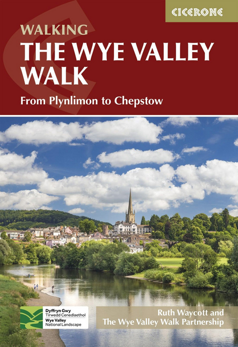
The Wye Valley Walk
Cicerone Press (Verlag)
978-1-78631-198-6 (ISBN)
The official guidebook to walking the Wye Valley Walk, from the river’s source on the slopes of Plynlimon through the countryside of the Wales–England border region to Chepstow. Covering 219km (136 miles), this straightforward trail takes around 10 days to hike.
The route is described from north to south in 17 stages of between 8 and 20km (5–12 miles). An extra stage from Llanidloes to the start of the trail is also included.
Contains step-by-step description of the route alongside 1:50,000 OS maps
Refreshment and public transport information given for each route stage
Stage facilities table and route summary table help you plan your itinerary
GPX files available to download
Notes on the region’s history and local points of interest
The Wye Valley Walk Partnership works to conserve and enhance the natural beauty of the area by promoting its economic and social development and its suitability for quiet and informal enjoyment to the public. The team work hard to maintain the area's beauty for future generations.
Introduction
Lower reaches of the Wye
Middle and Upper reaches of the Wye
Wildlife and nature conservation
Practicalities
How to use this guidebook
When to go
Maps
Public Rights of Way
Waymarks
Countryside code
Safe walking
Easy access
The Route
Stage 1 Chepstow Castle to Tintern Abbey
Stage 2 Tintern Abbey to Monmouth
Stage 3 Monmouth to Symonds Yat
Stage 4 Symonds Yat to Kerne Bridge
Stage 5 Kerne Bridge to Ross-on-Wye
Stage 6 Ross-on-Wye to Fownhope
Stage 7 Fownhope to Hereford
Stage 8 Hereford to Byford
Stage 9 Byford to Bredwardine
Stage 10 Bredwardine to Hay-on-Wye
Stage 11 Hay-on-Wye to Glasbury
Stage 12 Glasbury to Erwood
Stage 13 Erwood to Builth Wells
Stage 14 Builth Wells to Newbridge-on-Wye
Stage 15 Newbridge-on-Wye to Rhayader
Stage 16 Rhayader to Llangurig 1
Stage 17 Llangurig to Rhyd-y-benwch (Hafren Forest car park)
Stage 18 Leaving the Walk
Appendix 1 Route summary
Appendix 2 Tourist information and advice
Appendix 3 Accommodation and public transport
| Erscheinungsdatum | 22.08.2024 |
|---|---|
| Reihe/Serie | Cicerone guidebooks |
| Zusatzinfo | Colour photos and 18 OS map extracts |
| Verlagsort | Kendal |
| Sprache | englisch |
| Maße | 116 x 172 mm |
| Gewicht | 230 g |
| Themenwelt | Sachbuch/Ratgeber ► Sport |
| Reiseführer ► Europa ► Großbritannien | |
| Reisen ► Sport- / Aktivreisen ► Europa | |
| ISBN-10 | 1-78631-198-4 / 1786311984 |
| ISBN-13 | 978-1-78631-198-6 / 9781786311986 |
| Zustand | Neuware |
| Informationen gemäß Produktsicherheitsverordnung (GPSR) | |
| Haben Sie eine Frage zum Produkt? |
aus dem Bereich


