The Wye Valley Walk
Cicerone Press (Verlag)
978-1-85284-625-1 (ISBN)
- Titel ist leider vergriffen;
keine Neuauflage - Artikel merken
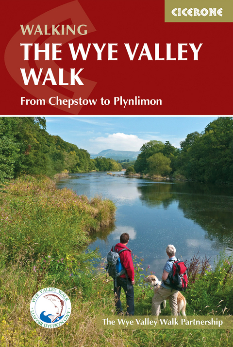
Official guidebook to the Wye Valley Walk. Following the River Wye for 136 miles (219km) from the mouth of the river at Chepstow to the slopes of Plynlimon in Powys, the Wye Valley offers a perfect mix of river and hill walking. The walk can be completed in about ten days, or seven days by the very fit and determined.
Devised by the Wye Valley Walk Partnership, the way explores the superb scenery of the Wye Valley Area of Outstanding Natural Beauty. Several historic market towns including Chepstow, Monmouth, Ross-on-Wye, Hereford, Hay-on-Wye, Builth Wells and Rhayader can be visited along the route, as well as many small villages and pretty hamlets.
Illustrated with colour photographs and OS 1:25,000 map extracts, and also includes a Wye Valley Walk passport, for walkers to collect stamps along the route for a permanent record of their journey. The walk leads through a dramatic limestone gorge, dense woodland beneath limestone crags and past peaceful river meadows in some of the most superb scenery in the heart of the Wye Valley.
The Wye Valley Walk Partnership works to conserve and enhance the natural beauty of the area by promoting its economic and social development and its suitability for quiet and informal enjoyment to the public. The team work hard to maintain the area's beauty for future generations.
Introduction
Lower reaches of the Wye
Middle and Upper reaches of the Wye
Wildlife and nature conservation
Practicalities
How to use this guidebook
When to go
Maps
Public Rights of Way
Waymarks
Countryside code
Safe walking
Easy access
The Route
Stage 1 Chepstow Castle to Tintern Abbey
Stage 2 Tintern Abbey to Monmouth
Stage 3 Monmouth to Symonds Yat
Stage 4 Symonds Yat to Kerne Bridge
Stage 5 Kerne Bridge to Ross-on-Wye
Stage 6 Ross-on-Wye to Fownhope
Stage 7 Fownhope to Hereford
Stage 8 Hereford to Byford
Stage 9 Byford to Bredwardine
Stage 10 Bredwardine to Hay-on-Wye
Stage 11 Hay-on-Wye to Glasbury
Stage 12 Glasbury to Erwood
Stage 13 Erwood to Builth Wells
Stage 14 Builth Wells to Newbridge-on-Wye
Stage 15 Newbridge-on-Wye to Rhayader
Stage 16 Rhayader to Llangurig 1
Stage 17 Llangurig to Rhyd-y-benwch (Hafren Forest car park)
Stage 18 Leaving the Walk
Appendix 1 Route summary
Appendix 2 Tourist information and advice
Appendix 3 Accommodation and public transport
| Erscheint lt. Verlag | 21.2.2023 |
|---|---|
| Reihe/Serie | Cicerone guidebooks |
| Zusatzinfo | Over 70 colour photos and OS map extracts |
| Verlagsort | Kendal |
| Sprache | englisch |
| Maße | 116 x 172 mm |
| Gewicht | 200 g |
| Themenwelt | Sachbuch/Ratgeber ► Sport |
| Reiseführer ► Europa ► Großbritannien | |
| Reisen ► Sport- / Aktivreisen ► Europa | |
| ISBN-10 | 1-85284-625-9 / 1852846259 |
| ISBN-13 | 978-1-85284-625-1 / 9781852846251 |
| Zustand | Neuware |
| Informationen gemäß Produktsicherheitsverordnung (GPSR) | |
| Haben Sie eine Frage zum Produkt? |
aus dem Bereich


