


Inland Waterways of Scotland Map
Seiten
2003
Imray, Laurie, Norie & Wilson Ltd (Verlag)
978-0-85288-714-1 (ISBN)
Imray, Laurie, Norie & Wilson Ltd (Verlag)
978-0-85288-714-1 (ISBN)
- Titel ist leider vergriffen;
keine Neuauflage - Artikel merken
Zu diesem Artikel existiert eine Nachauflage
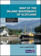
The production of this new and comprehensive map was prompted by the redesign of our chart C23 East Coast of Scotland. The plan of the Caledonian Canal was taken out of that chart and now becomes part of this map which also covers the Forth and Clyde Canals, Crinan Canal and an overview map showing the inter-relationship between the Scottish waterway system. It is a comprehensive reference to the waterways, embellished by the usual notes on dimensions, restrictions and formalities. The map provides all the necessary information for the yachtsman crossing between the east and west coasts of Scotland. On the reverse side, Jane Cumberlidge, who edited the map, has written interesting notes on the background and history of the waterways and also gives some indication of places to see and visit (that will be useful for the Scottish waterway enthusiasts). 25 x 35, 6.5 x 9 folded. Laminated cover.
| Erscheint lt. Verlag | 1.10.2003 |
|---|---|
| Mitarbeit |
Zusammenstellung: Jane Cumberlidge |
| Zusatzinfo | col. |
| Verlagsort | Huntingdon |
| Sprache | englisch |
| Maße | 148 x 210 mm |
| Themenwelt | Reisen ► Karten / Stadtpläne / Atlanten ► Europa |
| ISBN-10 | 0-85288-714-0 / 0852887140 |
| ISBN-13 | 978-0-85288-714-1 / 9780852887141 |
| Zustand | Neuware |
| Haben Sie eine Frage zum Produkt? |
Mehr entdecken
aus dem Bereich


aus dem Bereich
Straßen- und Freizeitkarte 1:250.000
Karte (gefalzt) (2023)
Freytag-Berndt und ARTARIA (Verlag)
12,90 €
Karte (gefalzt) (2023)
Freytag-Berndt und ARTARIA (Verlag)
12,90 €
Östersund
Karte (gefalzt) (2023)
Freytag-Berndt und ARTARIA (Verlag)
12,90 €