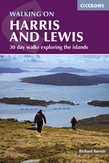
Walking on Harris and Lewis
Cicerone Press (Verlag)
978-1-78631-145-0 (ISBN)
A guidebook to 30 walks exploring the Scottish islands of Harris and Lewis in the Outer Hebrides. From shorter walks visiting historical, cultural and geological sites to more challenging hill walks, there are routes to suit all abilities.
The walks range from 4 to 22km (3–14 miles) and can be enjoyed in 1–8 hours. Also included is information on walking opportunities on other islands, including St Kilda, Berneray and the Shiant Islands.
1:50,000 OS maps included for each walk
Sized to easily fit in a jacket pocket
Refreshment options are given for each walk
Local points of interest are featured including Calanais Standing Stones
Includes a list of all the Marilyns (hills with a prominence of 150m or more) on Harris, Lewis and St Kilda
Richard Barrett spent his working life as a professional marketer, but still found time for climbing, winter mountaineering and sea kayaking. He first visited the Harris hills as a teenager and became a regular visitor. He lived in North Harris for a number of years, where he and his wife ran a guest house and, although now a city-dweller, he still makes frequent forays to the Hebrides, reconnecting with the wilderness and catching up with old friends.
Map key
Location of walks
Introduction
So what is an island?
Geology
Flowers and vegetation
Wildlife
Getting there
Getting around
Where to stay
Safety considerations
Midges
Footwear
Access
Maps
Place names
How to use this guide
Harris
Introduction
1 Ceapabhal and Toe Head
2 Roineabhal from Roghadal
3 Coast to Coast on the Coffin Route
4 Beinn Dhubh
5 The Scholars' Path
6 Scalpay
7 Circuit of Tòdun from Urgha
8 Cleit Ard
9 Liuthaid and Mullach a' Ruisg
10 The Skeaudale Horseshoe
11 An Cliseam Horseshoe from Àird a' Mhulaidh
12 Stulabhal, T&##xe8;ileasbhal and Uisgneabhal Mòr
13 Muladal, Ulabhal, Oireabhal and Cleiseabhal
14 Tiorga Mòr
15 Huiseabhal Mòr, Oireabhal and Huiseabhal Beag
Lewis
Introduction
16 Ceann Loch R&##xe8;asort from Loch Ròg Beag
17 Griomabhal, Naideabhal a-Muigh and Laibheal
18 Mealaisbhal, Cracabhal and Laibheal a Tuath
19 Tamanasbhal, Teinneasabhal, Tahabhal and Tarain
20 Suaineabhal from Cairisiadar
21 Bhalasaigh to Bostadh on Great Bernera
22 Calanais Standing Stones
23 Dun Ch&##xe0;rlabhaigh and the Gearrannan Blackhouses
24 West Side Coastal Path
25 Beinn Bhragair
26 Around the Butt of Lewis
27 Heritage Walk between Tolstadh and Port Nis
28 A walk to the tidal island of Eilean Chaluim Chille
29 The deserted village of Stiomrabhaigh
30 Beinn Mhòr
Walks on St Kilda and Other Islands
Appendix A Route Summary Table
Appendix B Gaelic Language
Appendix C Further Reading
Appendix D Marilyns on Harris, Lewis and St Kilda
| Erscheinungsdatum | 07.12.2022 |
|---|---|
| Reihe/Serie | Cicerone guidebooks |
| Zusatzinfo | 89 colour photos, 32 OS map extracts |
| Verlagsort | Kendal |
| Sprache | englisch |
| Maße | 116 x 172 mm |
| Gewicht | 230 g |
| Themenwelt | Sachbuch/Ratgeber ► Sport |
| Reisen ► Sport- / Aktivreisen ► Europa | |
| ISBN-10 | 1-78631-145-3 / 1786311453 |
| ISBN-13 | 978-1-78631-145-0 / 9781786311450 |
| Zustand | Neuware |
| Informationen gemäß Produktsicherheitsverordnung (GPSR) | |
| Haben Sie eine Frage zum Produkt? |
aus dem Bereich