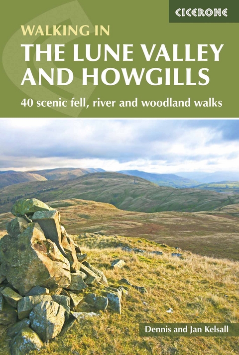
The Lune Valley and Howgills
Cicerone Press (Verlag)
978-1-85284-916-0 (ISBN)
A guidebook to 40 day walks in and around the valley of the River Lune, which wends its way between the Yorkshire Dales and the Lake District National Parks. From riverside paths to fell-tops and fields, there are walks for all abilities.
The walks range in length from 5–18km (3–11 miles) and can be enjoyed in between 1 and 6 hours. They are arranged geographically, following the Lune as it flows from near Kirkby Stephen in Cumbria, around the Howgill Fells and downstream towards its mouth on Morecambe Bay, Lancashire.
1:50,000 OS maps included for each walk
Sized to easily fit in a jacket pocket
GPX files available to download
Refreshment and public transport options are given for each walk
Information given on local geology and wildlife
Dennis and Jan Kelsall have long held a passion for countryside and hill walking. Since their first Cicerone title was published in 1995, they have written, contributed and illustrated over 50 guides to some of Britain's most popular walking areas and have become regular contributors to various outdoor magazines. Their enjoyment of the countryside extends far beyond a love of fresh air, open spaces and scenery. Over the years Dennis and Jan have developed a wider interest in the environment, its geology and wildlife, as well as an enthusiasm for delving into local history, which so often provides clues to interpreting the landscape.
Map key
Location of walks
Introduction
Origins and landscape
History
Wildlife
Transport
Accommodation and facilities
Navigation and maps
Planning your walk
Using this guide
Walk 1 Weasdale and Randygill Top
Walk 2 Newbiggin-on-Lune
Walk 3 Wath to Kelleth
Walk 4 Bowderdale and The Calf
Walk 5 Gaisgill to Orton
Walk 6 Orton Scar
Walk 7 Birk Beck
Walk 8 Bretherdale
Walk 9 Blease Fell
Walk 10 Jeffrey's Mount and Borrowdale
Walk 11 Whinfell and Borrowdale
Walk 12 Carlin Gill
Walk 13 Beck Foot
Walk 14 Firbank and Bridge End
Walk 15 Winder, Calders and The Calf
Walk 16 Sedbergh and the River Rawthey
Walk 17 Frostrow Fells and Dentdale
Walk 18 Beside the River Dee from Dent
Walk 19 Killington
Walk 20 Calf Top
Walk 21 Barbon Low Fell
Walk 22 Around Casterton
Walk 23 Kirkby Lonsdale
Walk 24 By the Lune from Kirkby Lonsdale
Walk 25 Leck Beck
Walk 26 Arkholme and the River Lune
Walk 27 Melling
Walk 28 Roeburndale
Walk 29 Whit Moor
Walk 30 Littledale
Walk 31 Clougha Pike
Walk 32 Aughton and the River Lune
Walk 33 Halton, the Crook o'Lune and Gray's Seat
Walk 34 Slyne and the Lune Aqueduct
Walk 35 Around Lancaster
Walk 36 The Lune and the Lancaster Canal
Walk 37 Glasson Dock and the Lancaster Canal Spur
Walk 38 Cockersand Abbey
Walk 39 Overton and Bazil Point
Walk 40 Sunderland Point
Appendix A Route summary table
Appendix B The Lune Valley end to end
Appendix C Useful contacts
| Erscheinungsdatum | 26.11.2017 |
|---|---|
| Reihe/Serie | Cicerone guidebooks |
| Zusatzinfo | 100 colour photos and 40 OS map extracts |
| Verlagsort | Kendal |
| Sprache | englisch |
| Maße | 116 x 172 mm |
| Gewicht | 240 g |
| Themenwelt | Sachbuch/Ratgeber ► Sport |
| Reiseführer ► Europa ► Großbritannien | |
| Reisen ► Sport- / Aktivreisen ► Europa | |
| ISBN-10 | 1-85284-916-9 / 1852849169 |
| ISBN-13 | 978-1-85284-916-0 / 9781852849160 |
| Zustand | Neuware |
| Haben Sie eine Frage zum Produkt? |
aus dem Bereich


