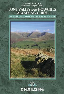
The Lune Valley and Howgills - A Walking Guide
Cicerone Press (Verlag)
978-1-85284-668-8 (ISBN)
- Titel erscheint in neuer Auflage
- Artikel merken
This guidebook offers a wide range of walks from the source of the river Lune in the Howgill Fells to Glasson Dock, just below Lancaster. The 40 day walks range from between 3 and 11 miles in length and are all illustrated with extracts of 1:50,000 OS mapping. They explore the infinitely varied landscape as the river Lune flows between the Lake District and Yorkshire Dales national parks and the Forest of Bowland and Arnside and Silverdale Areas of Outstanding Natural Beauty. Also included is a suggested 60-mile, 6-day route walking the River Lune from end to end, with lots of background information about the area's history, geology and also all the local facilities to help you plan your trip. There are magnificent views from the empty hilltops, delightful natural woodlands full of wildlife, stunning secluded side valleys and open moorland vistas to be explored in Yorkshire, Cumbria and Lancashire. And the walks are equally superb at any time of the year.
Both native Lancastrians, Dennis and Jan Kelsall have long held a shared passion for the countryside and hill walking. They have written and illustrated many guides to some of Britain's most popular walking areas and they regularly contribute to various outdoor magazines.
Overview map
Introduction
Origins and landscape
History
Wildlife
Transport
Accommodation and facilities
Navigation and maps
Planning your walk
Using this guide
The Walks
Walk 1 Weasdale and Randygill Top
Walk 2 Newbiggin-on-Lune
Walk 3 Wath to Kelleth
Walk 4 Bowderdale and The Calf
Walk 5 Gaisgill to Orton
Walk 6 Orton Scar
Walk 7 Birk Beck
Walk 8 Bretherdale
Walk 9 Blease Fell
Walk 10 Jeffrey's Mount and Borrowdale
Walk 11 Whinfell and Borrowdale
Walk 12 Carlin Gill
Walk 13 Beck Foot
Walk 14 Firbank and Bridge End
Walk 15 Winder, Calders and The Calf
Walk 16 Sedbergh and the River Rawthey
Walk 17 Frostrow Fells and Dentdale
Walk 18 Beside the River Dee from Dent
Walk 19 Killington
Walk 20 Calf Top
Walk 21 Barbon Low Fell
Walk 22 Around Casterton
Walk 23 Kirkby Lonsdale
Walk 24 By the Lune from Kirkby Lonsdale
Walk 25 Leck Beck
Walk 26 Arkholme and the River Lune
Walk 27 Melling
Walk 28 Roeburndale
Walk 29 Whit Moor
Walk 30 Littledale
Walk 31 Clougha Pike
Walk 32 Aughton and the River Lune
Walk 33 Halton, the Crook o'Lune and Gray's Seat
Walk 34 Slyne and the Lune Aqueduct
Walk 35 Around Lancaster
Walk 36 The Lune and the Lancaster Canal
Walk 37 Glasson Dock and the Lancaster Canal Spur
Walk 38 Cockersand Abbey
Walk 39 Overton and Bazil Point
Walk 40 Sunderland Point
Appendix A Route summary table
Appendix B The Lune Valley end to end
Appendix C Useful contacts
| Zusatzinfo | 100 colour photos and 40 OS map extracts |
|---|---|
| Verlagsort | Kendal |
| Sprache | englisch |
| Maße | 116 x 172 mm |
| Gewicht | 250 g |
| Themenwelt | Sachbuch/Ratgeber ► Sport |
| Reiseführer ► Europa ► Großbritannien | |
| ISBN-10 | 1-85284-668-2 / 1852846682 |
| ISBN-13 | 978-1-85284-668-8 / 9781852846688 |
| Zustand | Neuware |
| Haben Sie eine Frage zum Produkt? |
aus dem Bereich


