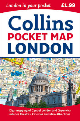
London Pocket Map
Seiten
2015
|
New edition
Collins (Verlag)
978-0-00-810456-6 (ISBN)
Collins (Verlag)
978-0-00-810456-6 (ISBN)
- Titel ist leider vergriffen;
keine Neuauflage - Artikel merken
Handy little full colour map of central London with a high level of detail. Clear mapping of central London from Regent’s Park in the north to Kennington in the south, and Kensington Gardens in the west to Tower Bridge in the east at a scale of 1:12,500 (5 inches to 1 mile). Maps of West End shopping and theatres are also included.
Clear, detailed, full colour mapping is presented in a handy format ideal for the pocket or handbag. It is excellent value at only £1.99 and covers the most visited area of central London. It is an essential buy for tourists and residents alike.
INCLUDES
Detailed central area map
Theatres and cinemas map
Shopping map
Underground map
The latest congestion zone boundary
Explore the world through accurate and up-to-date mapping.
| Erscheint lt. Verlag | 12.2.2015 |
|---|---|
| Verlagsort | London |
| Sprache | englisch |
| Maße | 90 x 140 mm |
| Gewicht | 40 g |
| Themenwelt | Reisen ► Karten / Stadtpläne / Atlanten ► Europa |
| Reisen ► Reiseführer | |
| ISBN-10 | 0-00-810456-5 / 0008104565 |
| ISBN-13 | 978-0-00-810456-6 / 9780008104566 |
| Zustand | Neuware |
| Haben Sie eine Frage zum Produkt? |
Mehr entdecken
aus dem Bereich
aus dem Bereich
Karte (gefalzt) (2023)
Freytag-Berndt und ARTARIA (Verlag)
12,90 €
Straßen- und Freizeitkarte 1:250.000
Karte (gefalzt) (2023)
Freytag-Berndt und ARTARIA (Verlag)
12,90 €
Narvik
Karte (gefalzt) (2023)
Freytag-Berndt und ARTARIA (Verlag)
12,90 €


