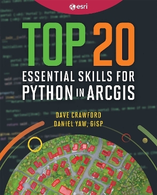
Top 20 Essential Skills for Python in ArcGIS
ESRI Press (Verlag)
978-1-58948-798-7 (ISBN)
- Noch nicht erschienen (ca. Oktober 2025)
- Versandkostenfrei innerhalb Deutschlands
- Auch auf Rechnung
- Verfügbarkeit in der Filiale vor Ort prüfen
- Artikel merken
Supercharge your ArcGIS workflows and enable others to work with your tools with the versatility of Python coding. Top 20 Essential Skills for Python in ArcGIS guides readers through integrating Python with ArcGIS capabilities, from performing market analytics to managing ArcGIS Online organizations, to delivering work through Jupyter Notebook and other applications. Solving complex geospatial problems and delivering solutions has never been easier.
Top 20 Essential Skills for Python in ArcGIS includes:
Easy-to-understand, step-by-step tutorials
Jargon-free explanations with plenty of illustrations and guidance
A single, dependable resource for learning how to use Python in ArcGIS
Topics about ArcPy™, ArcGIS API for Python, object-oriented programming, Jupyter Notebook, data engineering, UIs and packaging, solution development, ArcGIS Enterprise and ArcGIS Online, and much more.
These bite-sized chapters with easy-to-follow steps will help you to become adept at understanding and using Python in ArcGIS.
Dave Crawford is a technical consultant and Python developer with Esri’s Professional Services division based in Oakland, CA. Prior to his time working with geospatial data, he was an archaeologist. Now he spends his time designing and implementing data engineering and automation solutions. Daniel Yaw, GISP, is a seasoned Enterprise Solutions Architect and Developer with a strong background in GIS spanning over 15 years. His experience encompasses roles in the public sector and technology industries, including Esri’s Advanced Enterprise Systems team. Daniel is committed to leveraging technology and adopts a practical approach to designing and implementing efficient, innovative solutions that enhance operational efficiency and effectiveness.
Preface
Chapter 1: Designing your Python solution
Chapter 2: Functional programming -- Arcpy basics
Chapter 3: Functional programming -- ArcGIS Python API basics
Chapter 4: Object-oriented programming
Chapter 5: Jupyter notebooks
Chapter 6: Data manipulation
Chapter 7: Data engineering
Chapter 8: AI/ML
Chapter 9: Data visualization
Chapter 10: Interacting with databases
Chapter 11: Geoprocessing
Chapter 12: Geoprocessing toolboxes and services
Chapter 13: ArcGIS Enterprise and Online
Chapter 14: Working with web APIs
Chapter 15: Web frameworks
Chapter 16: Packaging
Chapter 17: Source control
Chapter 18: Documentation
Chapter 19: Debugging and troubleshooting
Chapter 20: Continuing your Python journey
| Erscheint lt. Verlag | 9.10.2025 |
|---|---|
| Zusatzinfo | Illustrations |
| Verlagsort | Redlands |
| Sprache | englisch |
| Maße | 190 x 234 mm |
| Themenwelt | Mathematik / Informatik ► Informatik ► Programmiersprachen / -werkzeuge |
| Informatik ► Software Entwicklung ► Objektorientierung | |
| Naturwissenschaften ► Geowissenschaften ► Geografie / Kartografie | |
| ISBN-10 | 1-58948-798-2 / 1589487982 |
| ISBN-13 | 978-1-58948-798-7 / 9781589487987 |
| Zustand | Neuware |
| Informationen gemäß Produktsicherheitsverordnung (GPSR) | |
| Haben Sie eine Frage zum Produkt? |
aus dem Bereich


