


Clans and Tartans Map of Scotland
2009
|
New edition
Collins (Verlag)
978-0-00-728950-9 (ISBN)
Collins (Verlag)
978-0-00-728950-9 (ISBN)
- Titel erscheint in neuer Auflage
- Artikel merken
Zu diesem Artikel existiert eine Nachauflage
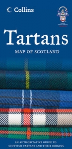
Pictorial Map of Scotland illustrating Scotland’s clans, tartans and family names. There is also information on places to visit with strong clan links as well as plant badges.
• Over 140 clans listed with illustrations of their tartans, cap badges and mottos, and plant badges.
• Map of Scotland, with height-shading, showing the territories of the principal clans at the beginning of the 17th century.
• Illustrations of crests, flags and banners and an explanation of their features.
• A comprehensive list of over 1000 surnames, with their associated clans, families and tartans, including District and military tartans.
• Lists of clan societies and Highland games.
• Internet sites and suggested reading for more information.
• Other titles in the series include:
Castles Map of Scotland
Whisky Map of Scotland
Clan and Family Names Map of Scotland
Lake District Walking Map
| Erscheint lt. Verlag | 2.4.2009 |
|---|---|
| Reihe/Serie | Pictorial Maps |
| Zusatzinfo | 140 col illus, Index |
| Verlagsort | London |
| Sprache | englisch |
| Maße | 124 x 257 mm |
| Gewicht | 95 g |
| Themenwelt | Reisen ► Karten / Stadtpläne / Atlanten ► Europa |
| Geisteswissenschaften ► Geschichte ► Hilfswissenschaften | |
| ISBN-10 | 0-00-728950-2 / 0007289502 |
| ISBN-13 | 978-0-00-728950-9 / 9780007289509 |
| Zustand | Neuware |
| Haben Sie eine Frage zum Produkt? |
Mehr entdecken
aus dem Bereich


aus dem Bereich
Straßen- und Freizeitkarte 1:250.000
Karte (gefalzt) (2023)
Freytag-Berndt und ARTARIA (Verlag)
12,90 €
Karte (gefalzt) (2023)
Freytag-Berndt und ARTARIA (Verlag)
12,90 €
Narvik
Karte (gefalzt) (2023)
Freytag-Berndt und ARTARIA (Verlag)
12,90 €