


Clans and Tartans Map of Scotland
2005
Collins (Verlag)
978-0-00-718461-3 (ISBN)
Collins (Verlag)
978-0-00-718461-3 (ISBN)
- Titel ist leider vergriffen;
keine Neuauflage - Artikel merken
Zu diesem Artikel existiert eine Nachauflage
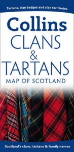
One of the relaunched Collins Pictorial Map titles, illustrating Scotland’s clans, tartans and family names.
• Over 140 clans listed with illustrations of their tartans, cap badges and mottos, and plant badges.
• Map of Scotland, with height-shading, showing the territories of the principal clans at the beginning of the 17th century.
• Illustrations of crests, flags and banners and an explanation of their features.
• A comprehensive list of over 1000 surnames, with their associated clans, families and tartans, including District and military tartans.
• Lists of clan societies and Highland games.
• Internet sites and suggested reading for more information.
• Other titles in the series include:
Castles Map of Scotland
Whisky Map of Scotland
Lake District Walking Map
| Erscheint lt. Verlag | 7.2.2005 |
|---|---|
| Reihe/Serie | Pictorial Maps |
| Zusatzinfo | 140 col illus, Index |
| Verlagsort | London |
| Sprache | englisch |
| Maße | 240 x 260 mm |
| Gewicht | 92 g |
| Themenwelt | Reisen ► Karten / Stadtpläne / Atlanten ► Europa |
| Geisteswissenschaften ► Geschichte ► Hilfswissenschaften | |
| ISBN-10 | 0-00-718461-1 / 0007184611 |
| ISBN-13 | 978-0-00-718461-3 / 9780007184613 |
| Zustand | Neuware |
| Haben Sie eine Frage zum Produkt? |
Mehr entdecken
aus dem Bereich


aus dem Bereich
Straßen- und Freizeitkarte 1:250.000
Karte (gefalzt) (2023)
Freytag-Berndt und ARTARIA (Verlag)
12,90 €
Karte (gefalzt) (2023)
Freytag-Berndt und ARTARIA (Verlag)
12,90 €
Narvik
Karte (gefalzt) (2023)
Freytag-Berndt und ARTARIA (Verlag)
12,90 €