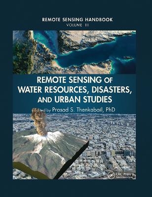
Remote Sensing of Water Resources, Disasters, and Urban Studies
Seiten
2019
CRC Press (Verlag)
978-0-367-86896-3 (ISBN)
CRC Press (Verlag)
978-0-367-86896-3 (ISBN)
This book is the most comprehensive documentation of the scientific and methodological advances that have taken place in understanding remote sensing data, methods, and applications over last 50 years. In a very practical way it demonstrates the experience, utility, methods and models used in studying a wide array of water applications. There ar
A volume in the three-volume Remote Sensing Handbook series, Remote Sensing of Water Resources, Disasters, and Urban Studies documents the scientific and methodological advances that have taken place during the last 50 years. The other two volumes in the series are Remotely Sensed Data Characterization, Classification, and Accuracies, and Land Resources Monitoring, Modeling, and Mapping with Remote Sensing.
In true handbook style, this volume demonstrates in-depth, extensive and comprehensive coverage of Remote Sensing of Water Resources, Disasters, and Urban Studies. The book provides fundamental as well as practical knowledge of remote sensing of myriad topics pertaining to water resources, disasters, and urban areas such as hydrology, water resources, water use, water productivity, floods, wetlands, snow and ice, nightlights, geomorphology, droughts and drylands, disasters, volcanoes, fire, and smart cities.
Highlights include:
Hydrological studies, groundwater studies, flood studies, and crop water use and water productivity studies
Wetland modeling, mapping, and characterization
Snow and ice studies
Drought and dryland monitoring and mapping methods
Volcanoes, coal fires, and greenhouse gas emissions
Urban remote sensing for disaster risk management
Remote sensing for the design of smart cities
Considered magnum opus on the subject the three-volume Remote Sensing Handbook is edited by Dr. Prasad S. Thenkabail, an internationally acclaimed scientist in remote sensing, GIScience, and spatial sciences. The volume has contributions from pioneering remote sensing global experts on specific topics. The volume gives you a knowledge base on each of the above mentioned topics, a deep understanding the evolution remote sensing science, and familiarity with state-of-th
Thenkabail Ph.D. and Prasad S.
Water. Hydrology. Geomorphology. Floods. Wetlands. Snow and Ice. Glaciers, Permafrost, and Ice. Droughts and Drylands. Disasters. Volcanoes. Fire. Urban. Nightlights. Advances in Water Remote Sensing.
| Erscheinungsdatum | 23.12.2019 |
|---|---|
| Reihe/Serie | Remote Sensing Handbook |
| Verlagsort | London |
| Sprache | englisch |
| Maße | 210 x 280 mm |
| Gewicht | 1306 g |
| Themenwelt | Naturwissenschaften ► Geowissenschaften ► Geografie / Kartografie |
| Technik ► Umwelttechnik / Biotechnologie | |
| Weitere Fachgebiete ► Land- / Forstwirtschaft / Fischerei | |
| ISBN-10 | 0-367-86896-2 / 0367868962 |
| ISBN-13 | 978-0-367-86896-3 / 9780367868963 |
| Zustand | Neuware |
| Haben Sie eine Frage zum Produkt? |
Mehr entdecken
aus dem Bereich
aus dem Bereich
über eine faszinierende Welt zwischen Wasser und Land und warum sie …
Buch | Hardcover (2023)
dtv (Verlag)
24,00 €
Richtlinien für die verkehrsrechtliche Sicherung von Arbeitsstellen …
Buch | Softcover (2022)
Kirschbaum (Verlag)
97,40 €


