Imray Chart Pack 3200
Imray, Laurie, Norie & Wilson Ltd (Verlag)
978-1-78679-457-4 (ISBN)
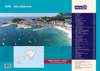
This fully revised edition of our popular 3200 Islas Baleares chart pack consists of 25 sheets. It includes the latest official Instituto Hidrografico de la Marina data, combined with additional information sourced from Imray''s network to make it ideal for small craft. The chart pack includes all the navigational charts required for passage, approach, and mooring, and is designed to be used alongside Balearic Islands by Royal Cruising Club Pilotage Foundation.
3200.1 Ibiza & Formentera (1:150 000)
3200.2 Ibiza Southwest (1:60 000)
3200.3 Ibiza Northwest (1:60 000)
Plan: Puerto de San Antonio (1:17 500)
3200.4 Ibiza East (1:60 000)
3200.5 Ibiza South to Formentera (1:60 000)
Plan: Puerto de Savina (1:10 000)
3200.6 Puerto de Ibiza (1:15 000) and Passage between Ibiza & Espalmador (1:25 000)
3200.7 Mallorca & Menorca (1:350 000)
3200.8 Mallorca - Bahia de Palma (1:50 000)
Plans: Cala Portals (Portals Vells) (1:10 000), Puerto de Portals Nous (1:10 000), San Antonio de la Playa (1:10 000), Puerto El Arenal (1:10 000)
3200.9 Puerto de Palma de Mallorca (1:17 500)
3200.10 Mallorca - Isla Dragonera to Punta de Cala Figuera (1:50 000)
Plans: Puerto de Andratx (1:10 000), Puerto de Santa Ponca (1:10 000), Puerto de Port Adriano (1:10 000)
3200.11 Mallorca - Punta S'Aliga to Puerto de Soller (1:50 000) and Cabo Tramuntana to Punta S'Aliga (1:50 000)
3200.12 Mallorca - Puerto de Soller to Punta Beca (1:50 000)
Plan: Puerto de Soller (1:10 000)
3200.13 Mallorca - Punta Beca to Puerto de Alcudia (1:50 000)
Plans: Approaches to Port de Pollenca (1:17 500), Bonaire (1:10 000)
3200.14 Mallorca - Bahia de Alcudia (1:50 000)
Plans: Puerto de Alcudia (1:15 000), Puerto de Ca'n Picafort (1:10 000), Puerto de Serra Nova (1:10 000), Colonia de Sant Pere (1:10 000)
3200.15 Mallorca - Cabo Ferrutx to Punta Rasa (1:50 000)
Plans: Puerto de Cala Ratjada (1:7500), Puerto de Cala Bona (1:10 000)
3200.16 Mallorca - Punta de N''Amer to Porto Petro (1:50 000)
Plans: Porto Cristo (1:10 000), Porto Colom (1:10 000)
3200.17 Mallorca - Colonia de Sant Jordi to Cala d'Or (1:50 000)
Plans: Cala Llonga (1:10 000), Porto Petro (1:10 000), Cala Figuera (1:10 000)
3200.18 Mallorca - Approaches to Cabrera (1:50 000)
Plans: Puerto de Cabrera (1:12 500), Cala Es Borri (1:15 000)
3200.19 Mallorca - Cabo Enderrocat to Cabo Blanco (1:50 000) and Cabo Blanco to Ensenada de la Rapita (1:50 000)
3200.20 Menorca (1:150 000)
3200.21 Menorca West (1:50 000)
Plan: Approaches to Ciudadela (1:10 000)
3200.22 Menorca North - Islotes Bledes to Addaia (1:50 000) and Puerto de Fornells (1:15 000)
3200.23 Menorca Northeast (1:50 000)
Plan: Puerto de Addaia (1:15 000)
3200.24 Menorca Southeast (1:50 000)
Plan: Puerto de Mahon (1:20 000)
3200.25 Approaches to Islas Baleares (1:700 000)
Imray Laurie Norie & Wilson Ltd was formed in 1904 when three private chart publishing firms amalgamated. Each of these London companies had a long history going back to the mid-18th century. James Imray and Son published an extensive list of charts and pilot books. RH Laurie and Sons was associated with charts published for the East India Company. Norie and Wilson, founded by JW Norie, whose Nautical Tables are still supplied to navigators across the world, produced charts and books on navigation and sold nautical instruments.Until 1939 we were based in the City of London, where long serving cartographers produced charts from copper plate engravings which were supplied to mariners throughout the World. For over a century Blueback Charts were the first choice of many shipping companies. Now based in St Ives in Cambridgeshire, Imray charts are produced digitally for printed and electronic editions by our drawing office team. Our catalogue of yachting charts is regarded by the sailing community as the most comprehensive available. Our paper charts are complemented by a growing list of electronic publications and high quality pilot books by leading authors.
| Erscheinungsdatum | 10.07.2023 |
|---|---|
| Reihe/Serie | 2000 series ; 3200 |
| Verlagsort | Huntingdon |
| Sprache | englisch |
| Maße | 425 x 594 mm |
| Themenwelt | Sachbuch/Ratgeber ► Sport ► Segeln / Tauchen / Wassersport |
| Technik ► Fahrzeugbau / Schiffbau | |
| ISBN-10 | 1-78679-457-8 / 1786794578 |
| ISBN-13 | 978-1-78679-457-4 / 9781786794574 |
| Zustand | Neuware |
| Haben Sie eine Frage zum Produkt? |
aus dem Bereich


