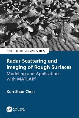
Radar Scattering and Imaging of Rough Surfaces
CRC Press (Verlag)
978-0-367-62799-7 (ISBN)
- Titel z.Zt. nicht lieferbar
- Versandkostenfrei innerhalb Deutschlands
- Auch auf Rechnung
- Verfügbarkeit in der Filiale vor Ort prüfen
- Artikel merken
Radar scattering and imaging of rough surfaces is an active interdisciplinary area of research with many practical applications in fields such as mineral and resource exploration, ocean and physical oceanography, military and national defense, planetary exploration, city planning and land use, environmental science, and many more. By focusing on the most advanced analytical and numerical modeling and describing both forward and inverse modeling, Radar Scattering and Imaging of Rough Surfaces: Modeling and Applications with MATLAB® connects the scattering process to imaging techniques by vivid examples through numerical and experimental demonstrations and provides computer codes and practical uses. This book is unique in its simultaneous treatment of radar scattering and imaging.
Key Features
Bridges physical modeling with simulation for resolving radar imaging problems (the first comprehensive work to do so)
Provides excellent basic and advanced information for microwave remote-sensing professionals in various fields of science and engineering
Covers most advanced analytical and numerical modeling for both backscattering and bistatic scattering
Includes MATLAB® codes useful not only for academics but also for radar engineers and scientists to develop tools applicable in different areas of earth studies
Covering both the theoretical and the practical, Radar Scattering and Imaging of Rough Surfaces: Modeling and Applications with MATLAB® is an invaluable resource for professionals and students using remote sensing to study and explain the Earth and its processes. University and research institutes, electrical and radar engineers, remote-sensing image users, application software developers, students, and academics alike will benefit from this book.
The author, Kun-Shan Chen, is an internationally known and respected engineer and scientist and an expert in the field of electromagnetic modeling.
Kun-Shan Chen earned a PhD in electrical engineering at the University of Texas at Arlington in 1990. From 1992 to 2014, he was a professor at the National Central University, Taiwan. From 2014 to 2019, he was with the Institute of Remote Sensing and Digital Earth, Chinese Academy of Sciences, China. Since 2019, he has been a professor at Guilin University of Technology, where his research interests include microwave remote sensing theory, modeling, system, and measurement, and intelligent signal processing and data analytics for radar. He has authored or co-authored over 160 refereed journal papers, contributed 10 book chapters, co-authored (with A. K. Fung) Microwave Scattering and Emission Models for Users (Artech House, 2010), authored Principles of Synthetic Aperture Radar: A System Simulation Approach (CRC Press, 2015), and co-edited (with X. Li, H. Guo, X. Yang) Advances in SAR Remote Sensing of Ocean (CRC Press, 2018). His academic activities include being a guest editor for a special issue on Remote Sensing for Major Disaster Prevention, Monitoring and Assessment (2007) in IEEE Transactions on Geoscience and Remote Sensing, a guest editor for the special issue on Remote Sensing for Natural Disaster (2012) in Proceedings of the IEEE, IEEE GRSS Adcom member (2010–2014), a founding chair of the GRSS Taipei Chapter, an associate editor of the IEEE Transactions on Geoscience and Remote Sensing since 2000, founding deputy editor-in-chief of IEEE Journal of Selected Topics in Applied Earth Observations and Remote Sensing (2008–2010). He served as guest editor of the special issue of Data Restoration and Denoising of Remote Sensing Data and special issues of Radar Imaging Theory, Techniques, and Applications, both for Remote Sensing, and was co-chair of the Technical Committee for IGARSS 2016 and IGARSS 2017. He served as a member of the editorial board of the Proceedings of the IEEE (2014–2019) and has been a member of the editorial board of the IEEE Access since 2020. He is a Fellow of IEEE.
1. Introduction 2. Statistical Description of Rough Surfaces 3. Basics of Electromagnetic Wave 4. Analytical Modeling of Rough Surface Scattering 5. Sensitivity Analysis of Radar Scattering of Rough Surface 6. Geophysical Parameters Estimation 7. Selected Model Applications to Remote Sensing 8. Radar Imaging Techniques 9. Computational Electromagnetic Imaging of Rough Surfaces 10. Advanced Topic: A Moon-Based Imaging of Earth’s Surface
| Erscheinungsdatum | 17.07.2023 |
|---|---|
| Reihe/Serie | SAR Remote Sensing |
| Zusatzinfo | 38 Tables, black and white; 248 Illustrations, color |
| Verlagsort | London |
| Sprache | englisch |
| Maße | 156 x 234 mm |
| Gewicht | 560 g |
| Themenwelt | Naturwissenschaften ► Geowissenschaften ► Geografie / Kartografie |
| Naturwissenschaften ► Geowissenschaften ► Geologie | |
| Technik ► Bauwesen | |
| Technik ► Elektrotechnik / Energietechnik | |
| Technik ► Umwelttechnik / Biotechnologie | |
| ISBN-10 | 0-367-62799-X / 036762799X |
| ISBN-13 | 978-0-367-62799-7 / 9780367627997 |
| Zustand | Neuware |
| Haben Sie eine Frage zum Produkt? |
aus dem Bereich


