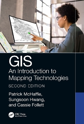
GIS
CRC Press (Verlag)
978-1-032-30897-5 (ISBN)
Features:
Uses the latest version of ArcGIS Pro (3.0) to present a fully rewritten and updated text with diverse perspectives.
Includes many real-world examples with urban planning, environmental, and social justice foci.
Presents new discussions, examples, and lab materials on open-source GIS projects.
Includes lab activities and data available for download from Support Materials.
Junior and senior level undergraduate students taking courses in remote sensing and GIS applications, studying in the fields of Geography, Environmental Sciences, Computer Science, Urban Studies, Public Health, and Social Disciplines, as well as researchers and academics in the same fields, will all benefit from the information provided in the updated version of this book.
Patrick McHaffie: Professor McHaffie joined the faculty at DePaul University in 1996 after academic appointments at West Virginia University, Dartmouth College, and West Georgia College. During the 1980s he served with the Kentucky Geological Survey where he conducted environmental research related to coal mining, directed the National Cartographic Information Center affiliate office, and coordinated the State Topographic Mapping Program. His research interests and publication history include the social history of cartography and GIS, the cartographic labor process, cartographic ethics, the geography of education spending, Appalachian social geography, and the social construction of the global. He currently is completing a study of highway planning in Chicago during the cold war. His work has been supported by grants from the National Science Foundation, History of Cartography Project (University of Wisconsin), and the University Research and Quality of Instruction Councils (DePaul University), and he holds a GIS Professional (GISP) certification. Sungsoon Hwang: Sungsoon Hwang is an associate professor in the Department of Geography at DePaul University. She earned her BA in Geography Education from Seoul National University. She earned her MS in Geographic Information Systems from the University of Nottingham. She earned her PhD in Geography with a concentration on Urban and Regional Analysis from State University of New York (SUNY) at Buffalo. She has created and taught 20 courses related to GIS. She has published on fuzzy geodemographics, GIS for sustainability education, and uncertain GPS trajectory computing in the disciplines of geography, urban planning, and computer science. Cassie Follett: Cassie Follett is the GIS Coordinator for the Department of Geography at DePaul University, helping to plan and expand GIS capabilities on-campus and managing the new GIS Lab. Before coming to DePaul she worked for NASA and the federal Environmental Protection Agency, and earned her MA from West Virginia University while researching big data and open-source web GIS. She holds a bachelor’s degree with a double major in Geography and History from Carthage College. ‘She contributes code to the open source QGIS project, and was a "Hacker in Residence" with local Chicago startup Hologram, and a "Cyberacademy Fellow" with SANS. Her research interests are participatory GIS, GIS programming, critical GIS, environmental justice, and virtual reality.
1. Making Sense of Geotechnology 2. Georeferencing 3. Getting the World into Your GIS 4. Geospatial Analysis: Introduction 5.Thematic Mapping 6. Data Models 7.Web GIS 8. Open-Source GIS 9. Introduction to Remote Sensing and GIS 10. Introduction to Health GIS Applications 11. GIS and Digital Humanities 12. Organizational GIS
| Erscheinungsdatum | 10.07.2023 |
|---|---|
| Zusatzinfo | 8 Tables, black and white; 13 Line drawings, color; 14 Line drawings, black and white; 226 Halftones, color; 60 Halftones, black and white; 239 Illustrations, color; 74 Illustrations, black and white |
| Verlagsort | London |
| Sprache | englisch |
| Maße | 178 x 254 mm |
| Gewicht | 720 g |
| Themenwelt | Naturwissenschaften ► Biologie ► Ökologie / Naturschutz |
| Naturwissenschaften ► Geowissenschaften ► Geografie / Kartografie | |
| Naturwissenschaften ► Geowissenschaften ► Geologie | |
| Technik ► Umwelttechnik / Biotechnologie | |
| ISBN-10 | 1-032-30897-4 / 1032308974 |
| ISBN-13 | 978-1-032-30897-5 / 9781032308975 |
| Zustand | Neuware |
| Haben Sie eine Frage zum Produkt? |
aus dem Bereich


