2200 The Solent Chart Pack Wirobound
Imray, Laurie, Norie & Wilson Ltd (Verlag)
978-1-78679-341-6 (ISBN)
- Titel erscheint in neuer Auflage
- Artikel merken
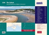
This fully revised and extended edition of our popular 2200 The Solent chart pack has been redesigned and expanded to 16 sheets. It includes the latest official UKHO data, combined with additional information sourced from Imray's network to make it ideal for small craft. The chart pack includes all the navigational charts and tidal data for passage, approach and mooring.
Included in this edition is improved coverage of the East Solent harbours. Chichester, Langstone and Portsmouth Harbour are now shown across five new sheets allowing these harbours and approaches to be covered at a better scale.
A new sheet has been added to show coastal navigation off the south coast of Isle of Wight, and a new index sheet of the Solent Approaches is now included.
2200.1 Solent Approaches (1:300 000)
2200.2 Christchurch to the Solent (1:60 000)
Plans: Lymington River (1:15 000), Christchurch (1:20 000)
2200.3 South Coast of the Isle of Wight (1:60 000)
2200.4 Eastern Approaches to the Solent (1:60 000)
2200.5 Portsmouth Harbour & Approaches (1:12 500)
2200.6 Portsmouth Harbour - Northern Part (1:12 500)
2200.7 Langstone Harbour (1:21 500)
Plan: Southsea Marina (1:15 000)
2200.8 Chichester Harbour (West) (1:21 500)
Plans: Northney Marina (1:12 500), Emsworth Yacht Harbour (1:12 500)
2200.9 Chichester Harbour (East) (1:21 500)
Plan: Birdham Pool & Chicester Marina (1:12 500)
2200.10 Central Solent (1:35 000)
2200.11 Southampton Water (1:35 000)
Plan: Continuation of Southampton Water (1:35 000)
2200.12 West Solent (1:35 000)
Plan: Yarmouth Harbour (1:4500)
2200.13 Isle of Wight Plans
Plans: Bembridge Harbour & Approaches (1:10 000), Newtown River (1:20 000), Cowes & River Medina (1:7500), Continuation of River Medina (1:12 500)
2200.14 Isle of Wight and Solent Plans
Plans: Wootton Creek (1:10 000), Ryde (1:20 000), Beaulieu River (1:20 000), Keyhaven (1:7500)
2200.15 River Itchen & Approaches (1:12 500)
2200.16 River Hamble (1:7500)
Imray Digital Charts: Free mobile download
A voucher code to download the relevant Imray digital charts into our Imray Navigator app is included with this atlas.
Imray Digital Charts: Free mobile download
A voucher code to download the relevant Imray digital charts into our Imray Navigator app is included with this atlas.
Imray Laurie Norie & Wilson Ltd was formed in 1904 when three private chart publishing firms amalgamated. Each of these London companies had a long history going back to the mid-18th century. James Imray and Son published an extensive list of charts and pilot books. RH Laurie and Sons was associated with charts published for the East India Company. Norie and Wilson, founded by JW Norie, whose Nautical Tables are still supplied to navigators across the world, produced charts and books on navigation and sold nautical instruments.Until 1939 we were based in the City of London, where long serving cartographers produced charts from copper plate engravings which were supplied to mariners throughout the World. For over a century Blueback Charts were the first choice of many shipping companies. Now based in St Ives in Cambridgeshire, Imray charts are produced digitally for printed and electronic editions by our drawing office team. Our catalogue of yachting charts is regarded by the sailing community as the most comprehensive available. Our paper charts are complemented by a growing list of electronic publications and high quality pilot books by leading authors.
| Erscheinungsdatum | 29.04.2022 |
|---|---|
| Reihe/Serie | 2000 Series ; 2200 |
| Verlagsort | Huntingdon |
| Sprache | englisch |
| Maße | 590 x 420 mm |
| Themenwelt | Sachbuch/Ratgeber ► Sport ► Segeln / Tauchen / Wassersport |
| Technik ► Fahrzeugbau / Schiffbau | |
| ISBN-10 | 1-78679-341-5 / 1786793415 |
| ISBN-13 | 978-1-78679-341-6 / 9781786793416 |
| Zustand | Neuware |
| Haben Sie eine Frage zum Produkt? |
aus dem Bereich