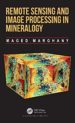
Remote Sensing and Image Processing in Mineralogy
CRC Press (Verlag)
978-0-367-89670-6 (ISBN)
Rounding out with practical simulations of 4-D open-pit mining identification and monitoring using the hologram radar interferometry technique, this book brings an effective new source of technology and applications for today’s minerology and petroleum engineers.
Key Features
• Helps develop new algorithms for retrieving mineral mining potential zones in remote sensing data.
• Solves specific problems surrounding the spectral signature libraries of different minerals in multispectral and hyperspectral data.
• Includes over 200 equations that illustrate how to follow examples in the book.
Prof. Maged Marghany is currently the director of Global Geoinformation, Sdn. Bhd. In 2020 he was ranked amongst the top 2 percent of scientists in a global list compiled by the prestigious Stanford University. He also ranked as the first oil spill scientist in a global list of over last 50 years compiled by the prestigious Universidade Estadual de Feira de Santana, Universidade Federal da Bahia, and Universidade Federal de Pernambuco; Brazil. He is the author of 6 titles including: Advanced Remote Sensing Technology for Tsunami Modelling and Forecasting which is published by Routledge Taylor and Francis Group, CRC and Synthetic Aperture Radar Imaging Mechanism for Oil Spills, which is published by Elsevier, His research specializes in microwave remote sensing and remote sensing for mineralogy detection and mapping. Previously, he worked as a professor of remote sensing in Indonesian and Malaysian universities. Maged has earned many degrees including a post-doctoral in radar remote sensing from the International Institute for Aerospace Survey and Earth Sciences, a PhD in environmental remote sensing from the Universiti Putra Malaysia, a Master of Science in Physical oceanography from the University Pertanian Malaysia, general and special Diploma of Education and a Bachelor of Science in physical oceanography from the University of Alexandria in Egypt. Maged has published well over 250 papers in international conferences and journals and is active in International Geoinformatic, and the International Society for Photogrammetry and Remote Sensing (ISPRS).
1. Principles of Mineralogy, Oil and Gas 2. Quantization of Minerals and their Interactions with Remote Sensing Photons 3. Quantum Computing of Image Processing 4. Quantum Spectral Libraries of Minerals in Optical Remote Sensing Data 5. Quantum Multispectral and Hyperspectral Remote Sensing Imaging of Alteration Minerals 6. Evolving Quantum Image Processing Tool for Lineament Automatic Detection in Optical Remote Sensing Satellite Data 7. Quantum Support Vector Machine in Retrieving Clay Mineral Saturation in Multispectral Sentinel-2 Satellite Data 8. Automatic Detection of Oil Seeps in Synthetic Aperture Radar Using Quantum Immune Fast Spectral Clustering 9. Quantum Interferometry Radar for Oil and Gas Explorations 10. Quantum Machine Learning Algorithm for Iron, Gold, and Copper Detection in Optical Remote Sensing Data 11. Four-Dimensional Hologram Interferometry for Automatic Detection of Copper Mineralization Using Terrasar-X Satellite Data
| Erscheinungsdatum | 08.03.2022 |
|---|---|
| Zusatzinfo | 13 Tables, black and white; 38 Line drawings, black and white; 5 Halftones, color; 197 Halftones, black and white; 5 Illustrations, color; 235 Illustrations, black and white |
| Verlagsort | London |
| Sprache | englisch |
| Maße | 156 x 234 mm |
| Gewicht | 720 g |
| Themenwelt | Informatik ► Grafik / Design ► Digitale Bildverarbeitung |
| Naturwissenschaften ► Geowissenschaften ► Geografie / Kartografie | |
| Naturwissenschaften ► Geowissenschaften ► Geologie | |
| Technik ► Elektrotechnik / Energietechnik | |
| Technik ► Umwelttechnik / Biotechnologie | |
| ISBN-10 | 0-367-89670-2 / 0367896702 |
| ISBN-13 | 978-0-367-89670-6 / 9780367896706 |
| Zustand | Neuware |
| Informationen gemäß Produktsicherheitsverordnung (GPSR) | |
| Haben Sie eine Frage zum Produkt? |
aus dem Bereich


