2100 Kent and Sussex Coasts Chart Pack
Imray, Laurie, Norie & Wilson Ltd (Verlag)
978-1-78679-262-4 (ISBN)
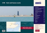
2100.1 Thames Estuary South
1: 120 000 WGS 84
2100.2 River Thames Sea Reach
1: 50 000 WGS 84
2100.3 The River Thames - Queen Elizabeth Bridge to Canvey Island
1: 35 000 WGS 84
Plans Coalhouse Point to Canvey Island, Queen Elizabeth II Bridge to Coalhouse Point
2100.4 The River Thames - Tower Bridge to Queen Elizabeth Bridge
1: 35 000 WGS 84
Plans Barking Creek to Queen Elizabeth II Bridge, Tower Bridge to Barking Creek
2100.5 River Medway
1: 40 000 WGS 84
Plans Gillingham Marina, Port Werburgh, Whitton Marine, Continuation of River Medway
2100.6 The Swale
1: 40 000 WGS 84
Plans Whitstable Harbour
2100.7 North Foreland to Dover & Calais
1: 115 000 WGS 84
2100.8 Dover to Dungeness & Cap Gris-Nez
1: 115 000 WGS 84
2100.9 Beachy Head to Dungeness
1: 115 000 WGS 84
Plans Sovereign Harbour, Rye Harbour
2100.10 Nab Tower to Beachy Head
1: 160 000 WGS 84
2100.11 Kent Plans - including plan of Calais
1: various WGS 84
Plans Ramsgate, River Stour Entrance, Dover, Calais, Folkestone
2100.12 Sussex Plans
1: various WGS 84
Plans Newhaven, Brighton Marina, Shoreham Harbour, Littlehampton, The Looe
Imray Laurie Norie & Wilson Ltd was formed in 1904 when three private chart publishing firms amalgamated. Each of these London companies had a long history going back to the mid-18th century. James Imray and Son published an extensive list of charts and pilot books. RH Laurie and Sons was associated with charts published for the East India Company. Norie and Wilson, founded by JW Norie, whose Nautical Tables are still supplied to navigators across the world, produced charts and books on navigation and sold nautical instruments.Until 1939 we were based in the City of London, where long serving cartographers produced charts from copper plate engravings which were supplied to mariners throughout the World. For over a century Blueback Charts were the first choice of many shipping companies. Now based in St Ives in Cambridgeshire, Imray charts are produced digitally for printed and electronic editions by our drawing office team. Our catalogue of yachting charts is regarded by the sailing community as the most comprehensive available. Our paper charts are complemented by a growing list of electronic publications and high quality pilot books by leading authors.
| Erscheinungsdatum | 21.06.2021 |
|---|---|
| Reihe/Serie | 2000 chart packs ; 2100 |
| Verlagsort | Huntingdon |
| Sprache | englisch |
| Maße | 420 x 590 mm |
| Gewicht | 66 g |
| Themenwelt | Sachbuch/Ratgeber ► Sport ► Segeln / Tauchen / Wassersport |
| Technik ► Fahrzeugbau / Schiffbau | |
| ISBN-10 | 1-78679-262-1 / 1786792621 |
| ISBN-13 | 978-1-78679-262-4 / 9781786792624 |
| Zustand | Neuware |
| Informationen gemäß Produktsicherheitsverordnung (GPSR) | |
| Haben Sie eine Frage zum Produkt? |
aus dem Bereich