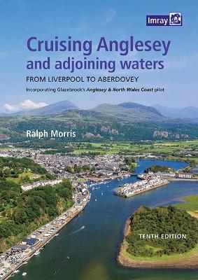
Cruising Anglesey and Adjoining Waters
Imray, Laurie, Norie & Wilson Ltd (Verlag)
978-1-78679-182-5 (ISBN)
Over the years, the pilot has been extended and it now provides information about tides, dangers, harbours and anchorages from Liverpool (marina) to Aberdovey (the same waters covered by Imray’s 2700 chart pack), plus the author’s own chart graphics.
This fully updated, tenth edition is spiral-bound for easy cockpit use, full colour, chart graphics, aerial views (courtesy of Google Earth) and nearly 100 original photos. It also makes reference to the most noteworthy event in recent years- the wholesale destruction of Holyhead Marina by Storm Emma in March 2018.
Ralph Morris learned his way around Anglesey the hard way - in a day boat with a single chart and a compass which one day chose to fail in fog. That's not the only thing which prompted the decision to write this pilot, though- the prime mover was the increasing scarcity of Henry Glazebrook's ‘Anglesey & North Wales Coast Pilot’, which got him out of many tight corners. The detail and precision of Glazebrook’s "Anglesey & North Wales Coast Pilot" is legendary and, through this guide, the author hopes to maintain its accessibility to all yachties sailing these waters.
Imray Laurie Norie & Wilson Ltd was formed in 1904 when three private chart publishing firms amalgamated. Each of these London companies had a long history going back to the mid-18th century. James Imray and Son published an extensive list of charts and pilot books. RH Laurie and Sons was associated with charts published for the East India Company. Norie and Wilson, founded by JW Norie, whose Nautical Tables are still supplied to navigators across the world, produced charts and books on navigation and sold nautical instruments.Until 1939 we were based in the City of London, where long serving cartographers produced charts from copper plate engravings which were supplied to mariners throughout the World. For over a century Blueback Charts were the first choice of many shipping companies. Now based in St Ives in Cambridgeshire, Imray charts are produced digitally for printed and electronic editions by our drawing office team. Our catalogue of yachting charts is regarded by the sailing community as the most comprehensive available. Our paper charts are complemented by a growing list of electronic publications and high quality pilot books by leading authors.
| Erscheinungsdatum | 10.05.2021 |
|---|---|
| Zusatzinfo | Full colour |
| Verlagsort | Huntingdon |
| Sprache | englisch |
| Gewicht | 96 g |
| Themenwelt | Sachbuch/Ratgeber ► Sport ► Segeln / Tauchen / Wassersport |
| Technik ► Fahrzeugbau / Schiffbau | |
| ISBN-10 | 1-78679-182-X / 178679182X |
| ISBN-13 | 978-1-78679-182-5 / 9781786791825 |
| Zustand | Neuware |
| Haben Sie eine Frage zum Produkt? |
aus dem Bereich


