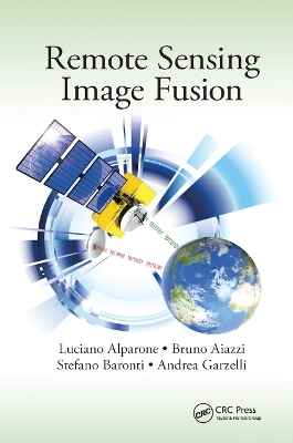
Remote Sensing Image Fusion
CRC Press (Verlag)
978-0-367-86818-5 (ISBN)
A synthesis of more than ten years of experience, Remote Sensing Image Fusion covers methods specifically designed for remote sensing imagery. The authors supply a comprehensive classification system and rigorous mathematical description of advanced and state-of-the-art methods for pansharpening of multispectral images, fusion of hyperspectral and panchromatic images, and fusion of data from heterogeneous sensors such as optical and synthetic aperture radar (SAR) images and integration of thermal and visible/near-infrared images. They also explore new trends of signal/image processing, such as compressive sensing and sparse signal representations.
The book brings a new perspective to a multidisciplinary research field that is becoming increasingly articulate and comprehensive. It fosters signal/image processing methodologies toward the goal of information extraction, either by humans or by machines, from remotely sensed images. The authors explain how relatively simple processing methods tailored to the specific features of the images may be winning in terms of reliable performance over more complex algorithms based on mathematical theories and models unconstrained from the physical behaviors of the instruments.
Ultimately, the book covers the births and developments of three generations of RS image fusion. Established textbooks are mainly concerned with the earliest generation of methods. This book focuses on second generation methods you can use now and new trends that may become third generation methods. Only the lessons learned with second generation methods will be capable of fostering the excellence among the myriad of methods that are proposed almost every day by the scientific literature.
Luciano Alparone received the Laurea degree (with honors) in electronic engineering from the University of Florence, Florence, Italy, in 1985 and the Ph.D. degree from the Italian Ministry of Education in 1990. During the spring of 2000 and summer of 2001, he was a Visiting Researcher at the Tampere International Centre for Signal Processing, Tampere, Finland. Since 2002, he has been an Associate Professor with the Images and Communications Laboratory, Department of Electronics and Telecommunications, University of Florence, where he currently holds the courses of Telecommunication Systems and Remote Sensing for Environmental Monitoring. He participated in several research projects funded by the Italian Ministry of University (MIUR), the Italian Space Agency (ASI), the French Space Agency (CNES), and the European Space Agency (ESA). Recently, he has been the Principal Investigator of a project funded by ASI on the processing of Cosmo-SkyMed SAR data. His research interests are data compression for remote sensing applications, multiresolution image analysis and processing, multisensor data fusion, analysis, and processing of SAR images. He has authored or coauthored over 60 papers in peer-reviewed journals and a total of 300 publications. Dr. Alparone was a corecipient of the 2004 Geoscience and Remote Sensing Letters Prize Paper Award for the study on "A global quality measurement of pansharpened multispectral imagery." Bruno Aiazzi received the Laurea degree in electronic engineering from the University of Florence, Florence, Italy, in 1991. Since 2001, he has been a Researcher with the Institute of Applied Physics "Nello Carrara" (IFAC-CNR), which is located in the CNR Area di Ricerca di Firenze, Florence. He is currently Senior Researcher in the IFAC-CNR Institute. He has been working in several international research projects funded by the main European space agencies (ASI, ESA, CNES) on remote sensing topics: image
Introduction. Sensors and Image Data Products. Quality Assessment. Image Resembling and Registration. Pan-Sharpening of Multi-Spectral Image Data. Pan-Sharpening of hyper-Spectral Image Data. Aliasing and Misregistration Effects in Pan-Sharpening. Integration of Images from Heterogeneous Sensors. New Trends.
| Erscheinungsdatum | 24.12.2019 |
|---|---|
| Reihe/Serie | Signal and Image Processing of Earth Observations |
| Verlagsort | London |
| Sprache | englisch |
| Maße | 156 x 234 mm |
| Gewicht | 453 g |
| Themenwelt | Naturwissenschaften ► Geowissenschaften ► Geologie |
| Naturwissenschaften ► Geowissenschaften ► Geophysik | |
| Technik ► Elektrotechnik / Energietechnik | |
| Technik ► Umwelttechnik / Biotechnologie | |
| ISBN-10 | 0-367-86818-0 / 0367868180 |
| ISBN-13 | 978-0-367-86818-5 / 9780367868185 |
| Zustand | Neuware |
| Informationen gemäß Produktsicherheitsverordnung (GPSR) | |
| Haben Sie eine Frage zum Produkt? |
aus dem Bereich


