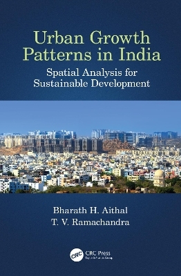
Urban Growth Patterns in India
CRC Press (Verlag)
978-0-367-22521-6 (ISBN)
This book uses spatio-temporal analysis to understand urbanisation in Indian cities and explain the concept and impact of global greenhouse gas (GHG) emissions. It creates a GHG footprint for Indian cities and engages in a discussion about the United Nations Sustainable Development Goals (SDGs) and smart city initiatives within an Indian context. Understanding the spatial patterns of land use/land cover (LULC) dynamics in the rapidly urbanising cities of India, the readers will be able to simulate future urbanisation patterns and use spatial temporal analysis as a tool for implementing appropriate mitigation measures.
Features
Analyses the complete urbanisation and urban sprawl of major cities in India using advanced geospatial modelling techniques
Highlights the best practices and methods used in modelling urban growth
Discusses greenhouse gas emissions from various sectors and their effects in local environments
Addresses the increase of local temperature in cities due to unplanned land use change and its impact on environmental sustainability and resilience
Fills the need for data-driven governance and policy decisions by introducing various analyses through spatial mapping
Highlighting some of the best practices and tools being used for modelling urban growth through case studies, the book is useful to those interested in using new technologies and methods for data collection and problem solving. It focuses on the major environmental issues in India, which are prevalent in most developing countries.
Dr. Bharath Haridas Aithal is an Assistant Professor at Ranbir & Chitra Gupta School of Infrastructure Design and Management, IIT Kharagpur, India. He works in the areas of data mining, digital image processing, visualization of spatial data, urban planning, machine learning, remote sensing, urban observatory, and spatial-temporal pattern analysis using Free and Open Source Software (FOSS). In 2009 he graduated in Electrical Engineering from the University Visvesvaraya College of Engineering, Bangalore University. In 2015 he earnd his PhD on Modelling Landscape Dynamics at the Indian Institute of Science (IISc), Bangalore. He continued his research as a Post-Doctoral Junior Research Associate at IISc and at the University of Southern California. He has received several awards and recognitions and has published many papers in peer reviewed journals. Dr. Ramachandra TV, PhD, is a Coordinator of Energy and Wetlands Research Group (EWRG), Convener of Environmental Information System (ENVIS) at Centre for Ecological Sciences (CES), Indian Institute of Science (IISc). He earned his doctoral degree in energy and environment from Indian Institute of Science. He has made significant contributions in the area of energy and environment. His research area includes wetlands, conservation, restoration and management of ecosystems, environmental management, GIS, remote sensing, regional planning and decision support systems. He teaches principles of remote sensing, digital image processing and Natural resources management. He has published over 250 research papers in reputed peer reviewed international and national journals, 200 papers in the international and national symposiums as well as 14 books. In addition, he has delivered a number of plenary lectures at national and international conferences. He is a fellow of Institution of Engineers (India), IEE (UK), Senior member, IEEE (USA) and many similar institutions. Details of his research and copies of publications are available at http://ces.iisc.ac.in/energy/ and http://ces.iisc.ac.in/grass
1. Landscape Dynamics: An Introduction 2. Quantification of Greenhouse Gas Footprint 3. Land Use and Land Cover Dynamics: Synthesis of Spatio-Temporal Patterns 4. Spatial Metrics: Tool for Understanding Spatial Patterns of Land Use and Land Cover Dynamics 5. Land Use Modelling: Future Research, Directions and Planning 6. Current Trends in Estimation of Land Surface Temperature Using Passive Remote Sensing Data 7. Sustainable Development Goals (SDGs): Disaster Mitigation in Flood-Prone Regions of India 8. Spatial Decision Support System (SDSS) for Urban Planning
| Erscheinungsdatum | 20.03.2020 |
|---|---|
| Zusatzinfo | 28 Tables, black and white; 32 Illustrations, color; 37 Illustrations, black and white |
| Verlagsort | London |
| Sprache | englisch |
| Maße | 156 x 234 mm |
| Gewicht | 521 g |
| Themenwelt | Naturwissenschaften ► Geowissenschaften ► Geografie / Kartografie |
| Technik ► Architektur | |
| Technik ► Umwelttechnik / Biotechnologie | |
| ISBN-10 | 0-367-22521-2 / 0367225212 |
| ISBN-13 | 978-0-367-22521-6 / 9780367225216 |
| Zustand | Neuware |
| Haben Sie eine Frage zum Produkt? |
aus dem Bereich


