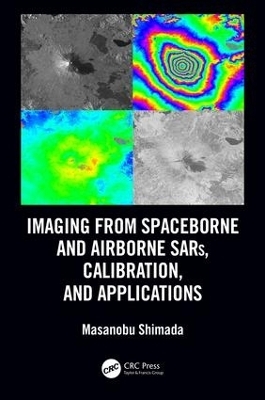
Imaging from Spaceborne and Airborne SARs, Calibration, and Applications
CRC Press (Verlag)
978-1-138-19705-3 (ISBN)
Sixty years after its birth, Synthetic Aperture Radar (SAR) evolved as a key player of earth observation, and it is continually upgraded by enhanced hardware functionality and improved overall performance in response to user requirements. The basic information gained by SAR includes the backscattering coefficient of targets, their phases (the truncated distance between SAR and its targets), and their polarization dependence. The spatiotemporal combination of the multiple data operated on the satellite or aircraft significantly increases its sensitivity to detect changes on earth, including temporal variations of the planet in amplitude and the interferometric change for monitoring disasters; deformations caused by earthquakes, volcanic activity, and landslides; environmental changes; ship detection; and so on. Earth-orbiting satellites with the appropriate sensors can detect environmental changes because of their large spatial coverage and availability.
Imaging from Spaceborne and Airborne SARs, Calibration, and Applications provides A-to-Z information regarding SAR researches through 15 chapters that focus on the JAXA L-band SAR, including hardware description, principles of SAR imaging, theoretical description of SAR imaging and error, ScanSAR imaging, polarimetric calibration, inflight antenna pattern, SAR geometry and ortho rectification, SAR calibration, defocusing for moving targets, large-scale SAR imaging and mosaic, interferometric SAR processing, irregularities, application, and forest estimation. Sample data are created by using L-band SAR, JERS-1, PALSAR, PALSAR-2, and Pi-SAR-L2.
This book is based on the author’s experience as a principal researcher at JAXA with responsibilities for L-band SAR operation and researches. It reveals the inside of SAR processing and application researches performed at JAXA, which makes this book a valuable reference for a wide range of SAR researchers, professionals, and students.
Masanobu Shimada (M’97–SM’04–F’11) received the BS and MS degrees in aeronautical engineering from Kyoto University in 1977 and 1979, and the PhD degree in electrical engineering from the University of Tokyo in 1999. He joined the National Space Development Agency of Japan (NASDA, former Japan Aerospace Exploration Agency (JAXA)) in 1979 and conducted the research projects for 34 years. During that, he made three achievements: 1) Sensor developments, i.e., Ku-band Scatterometer, Polarimetric Interferometric Airborne L-band SAR 1 and 2, 2) Operational Algorithm developments: SAR imaging, Interferometry, Polarimetry, Calibration, Mosaicking, and applications, 3) lead the science projects: the JERS-1 SAR calibration and validation (1992-1998), the JERS-1 Science project (Global rainforest and boreal forest mapping project and SAR interferometry for detecting the deformation distribution), the ALOS science project and PALSAR CALVAL, and the Kyoto and Carbon Initiative project using the time series PALSAR/PALSAR2 mosaics. His most impacted achievements are the deformation detection of the Hanshinn-Awaji-Earthquake using the JERS-1 SAR Interferometry, generation of world first global SAR mosaics that depicts the annual deforestation change, and experimental near real time deforestation monitoring using the ALOS/PALSAR ScanSAR. His current research interests are high resolution imaging for spaceborne and airborne SARs (PALSAR-2 and Pi-SAR-L2), calibration and validation, SAR applications including polarimetric SAR interferometry, and MTI using the UAVSAR interferometry. Since April 1 2015, He is a professor at Tokyo Denki University, an invited researcher of JAXA, and a guest professor of Yamaguchi University, and from 2018, a lecturer at the Nara Women University. At Tokyo Denki University, he brought up the graduation of the 18 students, on-going 6 master students.
1. Introduction 2. Introduction of the SAR System 3. SAR Imaging and Analysis 4. Radar Equation for SAR Correlation Power—Radiometry 5. ScanSAR Imaging 6. Polarimetric Calibration 7. SAR Elevation Antenna Pattern—Theory and Measured Pattern from the Natural Target Data 8. Geometry/Ortho-Rectification and Slope-Corrections 9. Calibration—Radiometry and Geometry 10. Defocusing and Image Shift due to the Moving Target 11. Mosaicking and Multi-Temporal SAR Imaging 12. SAR Interferometry 13. Irregularities (RFI and Ionosphere) 14. Applications 15. Forest Map Generation
| Erscheinungsdatum | 12.11.2018 |
|---|---|
| Reihe/Serie | SAR Remote Sensing |
| Zusatzinfo | 76 Tables, black and white; 158 Illustrations, color; 89 Illustrations, black and white |
| Verlagsort | London |
| Sprache | englisch |
| Maße | 178 x 254 mm |
| Gewicht | 907 g |
| Themenwelt | Informatik ► Grafik / Design ► Digitale Bildverarbeitung |
| Naturwissenschaften ► Geowissenschaften ► Geografie / Kartografie | |
| Technik ► Nachrichtentechnik | |
| ISBN-10 | 1-138-19705-X / 113819705X |
| ISBN-13 | 978-1-138-19705-3 / 9781138197053 |
| Zustand | Neuware |
| Informationen gemäß Produktsicherheitsverordnung (GPSR) | |
| Haben Sie eine Frage zum Produkt? |
aus dem Bereich


