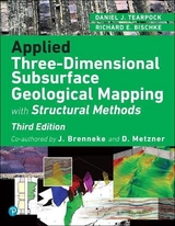
Applied Subsurface Geological Mapping with Structural Methods
Addison Wesley (Verlag)
978-0-13-091948-9 (ISBN)
- Titel erscheint in neuer Auflage
- Artikel merken
Applied Subsurface Geological Mapping, With Structural Methods, 2nd Edition is the practical, up-to-the-minute guide to the use of subsurface interpretation, mapping, and structural techniques in the search for oil and gas resources. Two of the industry's leading consultants present systematic coverage of the field's key principles and newest advances, offering guidance that is valuable for both exploration and development activities, as well as for "detailed" projects in maturely developed areas.
Fully updated and expanded, this edition combines extensive information from the published literature with significant material never before published. The authors introduce superior techniques for every major petroleum-related tectonic setting in the world.
Coverage includes:
A systematic, ten-step philosophy for subsurface interpretation and mapping
The latest computer-based contouring concepts and applications
Advanced manual and computer-based log correlation
Integration of geophysical data into subsurface interpretations and mapping
Cross-section construction: structural, stratigraphic, and problem-solving
Interpretation and generation of valid fault, structure, and isochore maps
New coverage of 3D seismic interpretation, from project setup through documentation
Compressional and extensional structures: balancing and interpretation
In-depth new coverage of strike-slip faulting and related structures
Growth and correlation consistency techniques: expansion indices, Multiple Bischke Plot Analysis, vertical separation versus depth, and more
Numerous field examples from around the world
Whatever your role in the adventure of finding and developing oil or gas resources–as a geologist, geophysicist, engineer, technologist, manager or investor–the tools presented in this book can make you significantly more effective in your daily technical or decision-oriented activities.
DANIEL J. TEARPOCK is Chairman and Chief Executive Officer of Subsurface Consultants & Associates, LLC. (SCA), the industry leader in worldwide upstream petroleum consultancy and training. As a working geoscientist, he has generated numerous exploration and exploitation prospects, either on his own or as part of an organized team. As a company, SCA has helped clients find or develop billions of barrels of oil equivalent. He is the co-author of Quick Look Techniques for Prospect Evaluation. RICHARD E. BISCHKE, Ph.D., Chief Structural Geophysicist of SCA, has conducted a wide range of structural geology projects, seismic interpretation, and balancing studies in extensional, compressional, and strike-slip environments. He specializes in the interpretation of complex structures, with recent studies in South America, the deepwater Gulf of Mexico, Alaska, Southeast Asia, and the North American Rocky Mountains.
Foreword.
Preface.
Acknowledgments.
Reviewers. Contributors. Drafting. Support Personnel. Contributing Authors. Special Recognition from Daniel J. Tearpock. Special Recognition from Richard E. Bischke. Biography of Daniel J. Tearpock. Biography of Richard E. Bischke.
1. Introduction to Subsurface Mapping.
Textbook Overview. The Philosophical Doctrine of Accurate Subsurface Interpretation and Mapping. Types Of Subsurface Maps and Cross Sections.
2. Contouring and Contouring Techniques.
Introduction . Three-Dimensional Perspective. Rules of Contouring. Methods of Contouring By Hand. Computer-Based Contouring Concepts and Applications.
3. Directionally Drilled Wells and Directional Surveys.
Introduction. Application of Directionally Drilled Wells. Common Types of Directionally Drilled Wells. Directional Well Plan. Directional Tools Used for Measurements. Directional Survey Calculations. Directional Survey Uncertainties. Directional Well Plots.
4. Log Correlation Techniques.
Introduction. Electric Log Correlation Procedures and Guidelines. Correlation Type Log. Electric Log Correlation—Vertical Wells. Electric Log Correlation—Directionally Drilled Wells. Electric Log Correlation—Horizontal Wells. Computer-Based Log Correlation. Repeated Section. Estimating Restored Tops. Unconformities. Annotation and Documentation.
5. Integration of Geophysical Data in Subsurface Mapping.
Introduction and Philosophy. The Process. Data Validation and Interpretation. Data Extraction. Some Final Thoughts on Seismic Mapping.
6. Cross Sections.
Introduction. Planning a Cross Section. Structural Cross Sections. Stratigraphic Cross Sections. Problem-Solving Cross Sections. Finished Illustration (Show) Cross Sections. Correlation Sections. Cross Section Design. Vertical Exaggeration. Projection of Wells. Cross Section Construction Across Faults. Three-Dimensional Views. Cross Section Construction Using a Computer. Fault Seal Analysis.
7. Fault Maps.
Introduction. Fault Terminology. Definition of Fault Displacement. Mathematical Relationship of Throw to Vertical Separation. Fault Data Determined From Well Logs. Fault Surface Map Construction. Types of Fault Patterns. Fault Data Determined From Seismic Information. Growth Faults. Directional Surveys and Fault Surface Maps. Vertical Separation—Correction Factor and Documentation.
8. Structure Maps.
Introduction. Guidelines to Contouring. Summary of the Methods of Contouring By Hand. Contouring Faulted Surfaces. Manual Integration of Fault and Structure Maps. Fault Traces and Gaps—Shortcuts and Pitfalls. Structure Map—Generic Case Study. The Additive Property of Faults. Integration of Seismic and Well Data for Structure Mapping. Other Mapping Techniques. Application of Contour Compatibility Across Faults. Mapping Techniques for Various Tectonic Habitats. Requirements for a Reasonable Structural. Interpretation and Completed Maps.
9. Interpretation of Three-Dimensional Seismic Data.
Introduction and Philosophy. Planning, Organizing and Documenting a Project. Fault Interpretation. Horizon Interpretation. Preliminary Structure Mapping. Horizon and Fault Integration on a Workstation. Conclusion.
10. Compressional Structures: Balancing and Interpretation.
Introduction. Structural Geology and Balancing. Mechanical Stratigraphy. Classical Balancing Techniques. Cross Section Consistency. Cross Section Construction. Depth to Detachment Calculations. Nonclassical Methods.
11. Extensional Structures: Balancing and Interpretation.
Introduction. Origin of Hanging Wall (Rollover) Anticlines. A Graphical Dip Domain Technique for Projecting Large Growth Faults to Depth. Origin of Synthetic and Antithetic Faults, Keystone Structures, and Downward Dying Growth Faults. Three-Dimensional Effects and Cross Structures. Strike-Ramp Pitfall. Compaction Effects Along Growth Normal Faults.
12. Strike-Slip Faults and Associated Structures.
Introduction. Mapping Strike-Slip Faults. Criteria for Strike-Slip Faulting. Analysis of Lateral Displacements. Scaling Factors for Strike-Slip Displacements. Balancing Strike-Slip Faults. Summary. Conclusions.
13. Growth Structures.
Introduction. Multiple Bischke Plot Analysis and d/d Methods. Accuracy of Method. Examples of the d/d Method. The Multiple Bischke Plot Analysis. Vertical Separation Versus Depth Method. Conclusions.
14. Isochore and Isopach Maps.
Introduction. Sand—Shale Distribution. Basic Construction of Isochore Maps. Methods of Contouring the Hydrocarbon Wedge. Vertical Thickness Determinations. Vertical Thickness and Fluid Contacts in Deviated Wells. Mapping the Top of Structure Versus The Top of Porosity. Fault Wedges. Nonsealing Faults. Volumetric Configuration of a Reservoir. Reservoir Volume Determinations from Isochore Maps. Introductory Reservoir Engineering. Interval Isopach Maps.
Appendix.
References.
Index.
| Erscheint lt. Verlag | 28.8.2002 |
|---|---|
| Mitarbeit |
Herausgeber (Serie): Sudul |
| Verlagsort | Boston |
| Sprache | englisch |
| Maße | 220 x 285 mm |
| Gewicht | 2080 g |
| Themenwelt | Naturwissenschaften ► Geowissenschaften ► Geologie |
| Technik ► Umwelttechnik / Biotechnologie | |
| ISBN-10 | 0-13-091948-9 / 0130919489 |
| ISBN-13 | 978-0-13-091948-9 / 9780130919489 |
| Zustand | Neuware |
| Haben Sie eine Frage zum Produkt? |
aus dem Bereich
