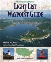
International Marine Light List and Waypoint Guide (The): Maine to Texas Including the Bahamas
International Marine Publishing Co (Verlag)
978-0-07-034301-6 (ISBN)
- Titel ist leider vergriffen;
keine Neuauflage - Artikel merken
U.S. Government light lists cover Maine to Texas in five volumes, each costing $25. Thanks to John and Leslie Kettlewell's painstaking editing, The International Marine Light List & Waypoint Guide offers the equivalent geographic coverage in one inexpensive volume. With its alphabetical listing of the significant lights and buoys within each state, which are also cross-referenced from the harbors or channels within which they may be found, this guide offers quick, clear access for boaters.Here in one convenient, accurate, compact, and economical package is information from five government Light Lists, with critical navigation information including: Latitude/longitude positions for thousands of lights, bouys, and daymarks; Light list data from the U.S. Coast Guard; Detailed descriptions of every aid to navigation; Alphabetical listings for quick reference; Coverage of coastal waters from Maine to Texas, including the Bahamas; GPS user's guide.
John Kettlewell (Saratoga Springs, NY) has cruised the waters between Labrador and the Caribbean with his wife, Leslie, for almost 30 years, often living aboard for long extended periods. He is a Commodore in the Seven Seas Cruising Association and has traversed the ICW between Norfolk and Miami two dozen times, most recently in 2007. John is a former editor for Reeds Nautical Almanac and for International Marine, and a former contributing editor for the Waterway Guides. John and Leslie conceived and edit The Intracoastal Waterway Chartbook, first published in 1992 and now entering its fifth edition. John and Leslie Kettlewell have cruised the waters between Labrador and the Caribbean for more than 25 years, often living aboard for extended periods of time. Both are Commodores in the Seven Seas Cruising Association, and they have traversed the ICW between Norfolk and Miami some twenty times and have sailed the Keys and the West Coast of Florida. The Kettlewells are freelance boating writers, editors, and photographers. John is a former editor for Chartkit and Reeds Nautical Almanac, one-time editor for International Marine, and a contributing editor for the Waterway Guides. HOMETOWN: Saratoga Springs, NY
Notice to MarinersPrefaceIntroductionSources of InformationHow to Use This BookGPSMaineNew HampshireMassachusettsRhode IslandConnecticutNew YorkNew JerseyDelawareMarylandVirginiaNorth CarolinaSouth CarolinaGeorgiaFloridaBahamasAlabamaMississippiLouisianaTexasAppendicesA: Characteristics of LightsB: Dayboard AbbreviationsC: Geographic Range TableD: Luminous Range DiagramGlossary
| Erscheint lt. Verlag | 16.11.1996 |
|---|---|
| Verlagsort | Rockport, ME |
| Sprache | englisch |
| Maße | 185 x 234 mm |
| Gewicht | 363 g |
| Themenwelt | Natur / Technik ► Fahrzeuge / Flugzeuge / Schiffe ► Schiffe |
| Sachbuch/Ratgeber ► Sport ► Segeln / Tauchen / Wassersport | |
| Technik ► Fahrzeugbau / Schiffbau | |
| ISBN-10 | 0-07-034301-2 / 0070343012 |
| ISBN-13 | 978-0-07-034301-6 / 9780070343016 |
| Zustand | Neuware |
| Haben Sie eine Frage zum Produkt? |
aus dem Bereich


