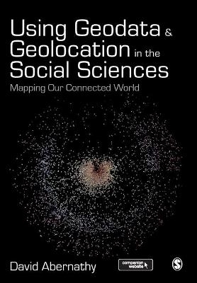
Using Geodata and Geolocation in the Social Sciences
Mapping our Connected World
Seiten
2016
SAGE Publications Ltd (Verlag)
978-1-4739-0818-5 (ISBN)
SAGE Publications Ltd (Verlag)
978-1-4739-0818-5 (ISBN)
Covering context, concepts, and theories, as well as the practice of how to capture and visualize Geodata, this full-colour text introduces readers to the Geoweb and how best to incorporate location-based data into research.
"Abernathy provides a truly accessible and interdisciplinary introduction to geodata and geolocation covering both the conceptual and the practical. It is a must read for students or researchers looking to make the most of the spatial elements of their data" - Luke Sloan, Senior Lecturer in Quantitative Methods, Cardiff University
Using Geodata and Geolocation in the Social Sciences: Mapping our Connected World provides an engaging and accessible introduction to the Geoweb with clear, step-by-step guides for:
Capturing Geodata from sources including GPS, sensor networks and Twitter
Visualizing Geodata using programmes including QGIS, GRASS and R
Featuring colour images, practical exercises walking you through using data sources, and a companion website packed with resources, this book is the perfect guide for students and teachers looking to incorporate location-based data into their social science research.
Introduction: The Power of Where
A Brief History of the Geoweb
“Big Geodata”: Managing Spatial Data in a Connected Age
Citizen Cartographers: Neogeography, VGI and the Democratization of Data Production
Challenges of the Geoweb: Data Accuracy, Privacy, and Surveillance
Introduction to Geodata: Types of Geodata; [see p. 9] How do we Identify and Gather Location-Based Data?
Capturing Absolute Location with the Global Positioning System
Geocoding, Geotagging & Geoparsing
Social Media Geodata: Capturing Location-Based Twitter Data
Mapping the Emerging Internet of Things
Visualizing Data in Geographic Information Systems with QGIS
Working with Geodata in GRASS
Working with Geodata in R
Web Mapping
Epilogue: Weaving the Geoweb
| Verlagsort | London |
|---|---|
| Sprache | englisch |
| Maße | 170 x 242 mm |
| Gewicht | 640 g |
| Themenwelt | Naturwissenschaften ► Geowissenschaften ► Geografie / Kartografie |
| Sozialwissenschaften ► Soziologie ► Empirische Sozialforschung | |
| ISBN-10 | 1-4739-0818-3 / 1473908183 |
| ISBN-13 | 978-1-4739-0818-5 / 9781473908185 |
| Zustand | Neuware |
| Haben Sie eine Frage zum Produkt? |
Mehr entdecken
aus dem Bereich
aus dem Bereich
über eine faszinierende Welt zwischen Wasser und Land und warum sie …
Buch | Hardcover (2023)
dtv (Verlag)
24,00 €
Richtlinien für die verkehrsrechtliche Sicherung von Arbeitsstellen …
Buch | Softcover (2022)
Kirschbaum (Verlag)
97,40 €


