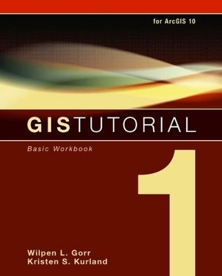
GIS Tutorial 1
Basic Workbook
Seiten
2010
|
4th ed.
ESRI Press
978-1-58948-259-3 (ISBN)
ESRI Press
978-1-58948-259-3 (ISBN)
- Titel ist leider vergriffen;
keine Neuauflage - Artikel merken
Updated for ArcGIS Desktop 10, "GIS Tutorial 1: Basic Workbook" provides effective GIS training in an easy-to-follow, step-by-step format. Includes a data CD for working through the exercises and fully functioning 180-day trial DVD of ArcGIS Desktop10 software.
Updated for ArcGIS Desktop 10, GIS Tutorial 1: Basic Workbook provides effective GIS training in an easy-to-follow, step-by-step format. By combining ArcGIS tutorials with self-study exercises intended to gradually build upon basic skills, the GIS Tutorial 1 is fully adaptable to individual needs, as well as the classroom setting. The tutorial demonstrates a range of GIS functionality, from creating maps and collecting data to using geoprocessing tools and models as well as ArcGIS 3D Analyst and ArcGIS Spatial Analyst extensions for further analysis. GIS Tutorial 1 includes a data CD for working through the exercises and fully functioning 180-day trial DVD of ArcGIS Desktop10 software, making it the smart choice for GIS beginners.
Updated for ArcGIS Desktop 10, GIS Tutorial 1: Basic Workbook provides effective GIS training in an easy-to-follow, step-by-step format. By combining ArcGIS tutorials with self-study exercises intended to gradually build upon basic skills, the GIS Tutorial 1 is fully adaptable to individual needs, as well as the classroom setting. The tutorial demonstrates a range of GIS functionality, from creating maps and collecting data to using geoprocessing tools and models as well as ArcGIS 3D Analyst and ArcGIS Spatial Analyst extensions for further analysis. GIS Tutorial 1 includes a data CD for working through the exercises and fully functioning 180-day trial DVD of ArcGIS Desktop10 software, making it the smart choice for GIS beginners.
Wilpen L. Gorr is a professor of public policy and management information systems at the H. John Heinz III School of Public Policy and Management, Carnegie Mellon University, where he teaches and researches GIS applications. Kristen S. Kurland holds a joint faculty appointment at Carnegie Mellon University's Heinz School of Public Policy and Management and School of Architecture, where she teaches GIS, CAD, 3D Visualization, and Computer Aided Facilities Management (CAFM).
| Erscheint lt. Verlag | 30.11.2010 |
|---|---|
| Verlagsort | Redlands |
| Sprache | englisch |
| Maße | 203 x 254 mm |
| Themenwelt | Naturwissenschaften ► Geowissenschaften ► Geografie / Kartografie |
| Sozialwissenschaften ► Pädagogik | |
| ISBN-10 | 1-58948-259-X / 158948259X |
| ISBN-13 | 978-1-58948-259-3 / 9781589482593 |
| Zustand | Neuware |
| Informationen gemäß Produktsicherheitsverordnung (GPSR) | |
| Haben Sie eine Frage zum Produkt? |
Mehr entdecken
aus dem Bereich
aus dem Bereich
Wasserstraßen zwischen Emmerich, Hörstel und Mainz
Media-Kombination (2023)
Kartenwerft
49,90 €
