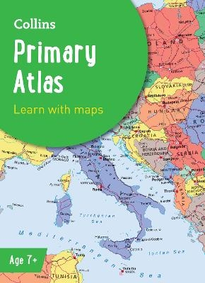
Collins Primary Atlas
Ideal for Learning at School and at Home
Seiten
2022
|
7th Revised edition
Collins (Verlag)
978-0-00-848594-8 (ISBN)
Collins (Verlag)
978-0-00-848594-8 (ISBN)
Zu diesem Artikel existiert eine Nachauflage
The must-have atlas for children aged 7-11
Collins Primary Atlas is a great introduction to mapping of the UK, Europe and all major regions of the world. It supports the Key Stage 2 curriculum and is suitable for children aged 7-11 years.
This new, fully up-to-date edition includes information on map reading skills, the meaning of scale and measuring distances, and is ideal for classroom use or home learning.
Reference maps:
• Informative, politically coloured and easy-to-read
• National capitals and major cities are clearly labelled
• Maps are supported with national flags and basic national statistics
Continental maps:
• Linked to regional mapping
• Supported by a selection of aerial and terrestrial photographs
• Relief maps show layer colouring and highlight major physical features
This atlas is also available in a Kindle format. The next atlas in the series is the Collins School Atlas, suitable for ages 11+ and KS3.
Explore the world through accurate and up-to-date mapping.
| Erscheinungsdatum | 28.07.2023 |
|---|---|
| Reihe/Serie | Collins School Atlases |
| Verlagsort | London |
| Sprache | englisch |
| Maße | 226 x 312 mm |
| Gewicht | 280 g |
| Themenwelt | Schulbuch / Wörterbuch ► Schulbuch / Allgemeinbildende Schulen |
| ISBN-10 | 0-00-848594-1 / 0008485941 |
| ISBN-13 | 978-0-00-848594-8 / 9780008485948 |
| Zustand | Neuware |
| Haben Sie eine Frage zum Produkt? |
Mehr entdecken
aus dem Bereich
aus dem Bereich
Wissen und verstehen - Ein Handbuch für die Sekundarstufe II
Buch | Hardcover (2022)
hep verlag
58,00 €


