


Blackpool A-Z Pocket Street Map
Seiten
2020
Harpercollins (Verlag)
978-0-00-838804-1 (ISBN)
Harpercollins (Verlag)
978-0-00-838804-1 (ISBN)
- Titel erscheint in neuer Auflage
- Artikel merken
Zu diesem Artikel existiert eine Nachauflage
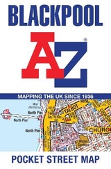
Navigate your way around Blackpool with detailed street maps from A-Z
This fully updated, folded A-Z street map includes all of the 2,100 streets in and around Blackpool. As well as the Promenade this handy map covers Great Marton Moss, Common Edge, Pleasure Beach, Hawes Side, Staining, Laytoun, North Shore and Warbreck.
The large scale 1 mile to 4.5 inch street map includes the following;
• Places of interest
• Blackpool tramway stops and route (Cavendish Road to Starr Gate)
• Postcode districts, one-way streets and car parks
• Index to streets, places of interest, place and area names, park and ride sites, national rail stations, hospitals and hospices
The perfect reference map for finding your way around Blackpool.
Britain’s leading street map publisher providing cartographic services, digital data products and paper mapping publications (including Street Atlases, Visitors Guides, Great Britain Road Atlases and The Adventure Atlas)..
| Erscheint lt. Verlag | 20.2.2020 |
|---|---|
| Verlagsort | London |
| Sprache | englisch |
| Maße | 90 x 140 mm |
| Gewicht | 40 g |
| Themenwelt | Reisen ► Karten / Stadtpläne / Atlanten ► Europa |
| Schulbuch / Wörterbuch ► Lexikon / Chroniken | |
| ISBN-10 | 0-00-838804-0 / 0008388040 |
| ISBN-13 | 978-0-00-838804-1 / 9780008388041 |
| Zustand | Neuware |
| Haben Sie eine Frage zum Produkt? |
Mehr entdecken
aus dem Bereich


aus dem Bereich
Straßen- und Freizeitkarte 1:250.000
Karte (gefalzt) (2023)
Freytag-Berndt und ARTARIA (Verlag)
12,90 €
Karte (gefalzt) (2023)
Freytag-Berndt und ARTARIA (Verlag)
12,90 €
Östersund
Karte (gefalzt) (2023)
Freytag-Berndt und ARTARIA (Verlag)
12,90 €