


Philips Modern School Atlas 94th Edition
Seiten
2003
Philip's (Verlag)
978-0-540-08087-8 (ISBN)
Philip's (Verlag)
978-0-540-08087-8 (ISBN)
- Titel erscheint in neuer Auflage
- Artikel merken
Zu diesem Artikel existiert eine Nachauflage
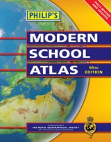
Backed up by numerous charts, graphs, tables, satellite imagery and thematic maps, this school atlas provides highly detailed mapping of the world. The material has been updated for the 94th edition and is designed for use in the classroom or at home.
A completely new edition of Britain's best-selling secondary school atlas, Philip's Modern School Atlas is divided into sections for case of use, with each page colour-coded for rapid reference. The first section covers the British Isles in 32 pages. With physically coloured maps, this is the most accurate mapping of the British Isles available at the chosen scales. Accompanying the physical maps are thematic maps of the British Isles on numerous key social and economic themes. A 16-page Satellite and Remote Sensing section follows, covering such topics as satellite imagery and GIS (with an explanation of false-colour usage), and incorporating a selection of images used in studies of exploration, land reclamation, erosion, geology and pollution, with explanatory text. The middle section is made up of 72 pages of World topographical maps, incorporating continental thematic maps on topics such as climate, population and economics, followed by 32 pages of World thematic maps. Completing the atlas is a section of World statistics, accompanied by the index to the topographical maps in the atlas, showing letter-figure grid references as well as latitude and longitude co-ordinates.The page numbering is now sequential throughout and the British Isles and World indexes are fully integrated.
Philip's Modern School Atlas is an unbeatable combination of highly detailed physical mapping backed up by numerous tables and thematic maps.
| Erscheint lt. Verlag | 15.4.2003 |
|---|---|
| Zusatzinfo | maps, charts, tables, graphs |
| Verlagsort | London |
| Sprache | englisch |
| Maße | 233 x 294 mm |
| Gewicht | 975 g |
| Themenwelt | Schulbuch / Wörterbuch |
| ISBN-10 | 0-540-08087-X / 054008087X |
| ISBN-13 | 978-0-540-08087-8 / 9780540080878 |
| Zustand | Neuware |
| Haben Sie eine Frage zum Produkt? |
Mehr entdecken
aus dem Bereich


aus dem Bereich
Buch | Softcover (2024)
Community Editions (Verlag)
14,00 €
For Little Learners Who Want to Know Everything
Buch | Hardcover (2024)
DK Children (Verlag)
21,15 €