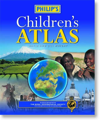
Philip's Children's Atlas
Seiten
2002
|
10th Revised edition
Philip's (Verlag)
978-0-540-08074-8 (ISBN)
Philip's (Verlag)
978-0-540-08074-8 (ISBN)
- Titel ist leider vergriffen;
keine Neuauflage - Artikel merken
The authors combine accurate cartography and fascinating facts about the countries of the world to provide essential geographical information for young readers. It is a book which is both fun to use and easy to understand. Quiz questions, activity ideas and puzzles are included.
This highly acclaimed illustrated world atlas for 7-12 years olds, now in its 10th edition, has been fully revised and updated for 2002. Spread by spread, the atlas contents are structured to follow the classic arrangement adopted by most cartographers since the 16th century: first Europe, then its land neighbour Asia, then Africa, Australia and Oceania, North America and South America. Clear, accurate cartography and fascinating facts about the countries of the world combine to provide essential geographical information for young readers. In addition, guidance is given at the beginning of the atlas on how to use the maps, encouraging the early development of map skills. Illustrated with interesting full-colour photographs and packed with fact boxes, curiosities, flags, stamps and quiz questions, Philip's Children's Atlas is both fun to use and easy to understand.
This highly acclaimed illustrated world atlas for 7-12 years olds, now in its 10th edition, has been fully revised and updated for 2002. Spread by spread, the atlas contents are structured to follow the classic arrangement adopted by most cartographers since the 16th century: first Europe, then its land neighbour Asia, then Africa, Australia and Oceania, North America and South America. Clear, accurate cartography and fascinating facts about the countries of the world combine to provide essential geographical information for young readers. In addition, guidance is given at the beginning of the atlas on how to use the maps, encouraging the early development of map skills. Illustrated with interesting full-colour photographs and packed with fact boxes, curiosities, flags, stamps and quiz questions, Philip's Children's Atlas is both fun to use and easy to understand.
David and Jill Wright began their careers as geography teachers, before moving into teacher training. They now travel the world extensively, researching new material for educational and children's books. They live in Mulbarton, Norfolk.
| Erscheint lt. Verlag | 16.12.2002 |
|---|---|
| Zusatzinfo | illustrations |
| Verlagsort | London |
| Sprache | englisch |
| Maße | 246 x 300 mm |
| Gewicht | 721 g |
| Themenwelt | Schulbuch / Wörterbuch |
| ISBN-10 | 0-540-08074-8 / 0540080748 |
| ISBN-13 | 978-0-540-08074-8 / 9780540080748 |
| Zustand | Neuware |
| Haben Sie eine Frage zum Produkt? |
Mehr entdecken
aus dem Bereich
aus dem Bereich
Buch | Softcover (2024)
Community Editions (Verlag)
14,00 €
Geometrie und Rechnen mit Größen
Buch | Hardcover (2024)
Kallmeyer (Verlag)
29,95 €


