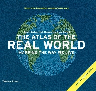
The Atlas of the Real World
Mapping the Way We Live
Seiten
2010
|
Revised and expanded edition
Thames & Hudson Ltd (Verlag)
978-0-500-28853-5 (ISBN)
Thames & Hudson Ltd (Verlag)
978-0-500-28853-5 (ISBN)
- Titel ist leider vergriffen;
keine Neuauflage - Artikel merken
Includes 366 digitally modified maps known as cartograms that depict the areas and countries of the world by their demographic importance on a range of topics, ranging from basic data on population, health, wealth and occupation to how many toys we import and who's eating their vegetables.
Now available in paperback, this reference book has everything we need to make sense of today’s world. 366 digitally modified maps – known as cartograms – depict the areas and countries of the world by their demographic importance on a vast range of topics, ranging from basic data on population, health, wealth and occupation to how many toys we import and who’s eating their vegetables. Created by the team behind worldmapper.org, The Atlas of the Real World book is an invaluable resource for home reference, schools, universities, journalists and trend-spotting professionals everywhere.
Now available in paperback, this reference book has everything we need to make sense of today’s world. 366 digitally modified maps – known as cartograms – depict the areas and countries of the world by their demographic importance on a vast range of topics, ranging from basic data on population, health, wealth and occupation to how many toys we import and who’s eating their vegetables. Created by the team behind worldmapper.org, The Atlas of the Real World book is an invaluable resource for home reference, schools, universities, journalists and trend-spotting professionals everywhere.
Daniel Dorling is Professor of Human Geography at the University of Sheffield, UK. Mark Newman is The Paul Dirac Collegiate Professor of Physics at the University of Michigan, USA. Anna Barford is a Research Associate at the University of Sheffield, UK.
| Erscheint lt. Verlag | 4.10.2010 |
|---|---|
| Zusatzinfo | with 382 colour maps |
| Verlagsort | London |
| Sprache | englisch |
| Maße | 268 x 232 mm |
| Gewicht | 1940 g |
| Themenwelt | Reisen ► Karten / Stadtpläne / Atlanten ► Welt / Arktis / Antarktis |
| Schulbuch / Wörterbuch ► Lexikon / Chroniken | |
| Naturwissenschaften ► Geowissenschaften ► Geografie / Kartografie | |
| ISBN-10 | 0-500-28853-4 / 0500288534 |
| ISBN-13 | 978-0-500-28853-5 / 9780500288535 |
| Zustand | Neuware |
| Haben Sie eine Frage zum Produkt? |
Mehr entdecken
aus dem Bereich
aus dem Bereich
mit Fakten und Infos zu allen Kontinenten
Buch | Hardcover (2024)
Kosmos Kartografie in der Franckh-Kosmos Verlags-GmbH & Co. …
24,00 €


