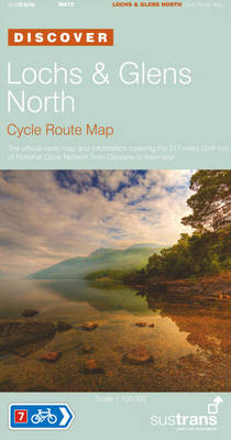
Lochs and Glens North - Sustrans Cycle Route Map
Sustrans Official Cycle Route Map and Information Covering the 217 Miles of National Cycle Network from Glasgow to Inverness
2006
|
2nd Revised edition
Sustrans (Verlag)
978-1-901389-62-3 (ISBN)
Sustrans (Verlag)
978-1-901389-62-3 (ISBN)
- Titel ist leider vergriffen;
keine Neuauflage - Artikel merken
The National Route 7 is a beautiful route passing through two National Parks, Loch Lomond and the Trossachs National Park. Covering the 217 miles of National Cycle Network from Glasgow to Inverness, this route map shows a traffic-free path that takes you from Glasgow, along the rivers Clyde and Leven, to the shores of Loch Lomond, and more.
This is a cycling route map. "The Discover Series of Sustrans Official Cycle Route Maps" provide clearly mapped cycle routes on traffic-free paths, quiet lanes and traffic-calmed roads. They are easy to read contours and route profiles, and contain visitor information and detailed routes through towns. This is the Official Route Map covering the 217 miles of National Cycle Network from Glasgow to Inverness. Offered in a fold-out format, it is a full colour, waterproof map. It is presented in the scale of 1:100,000, and has a splash-proof plastic sleeve. National Route 7 from Glasgow to Inverness is a beautiful route passing through two National Parks. Loch Lomond and the Trossachs National Park contains lochs, forests and bustling towns. The Cairngorms National Park extends over the UK's largest mountain range. A traffic-free path takes you from Glasgow, along the rivers Clyde and Leven, to the shores of Loch Lomond. The route takes in the lochs of Drunkie, Venachar, Lubnaig, Earn and Tay. Glen Ogle with its old railway viaducts is one of the highlights of the route.
This is a cycling route map. "The Discover Series of Sustrans Official Cycle Route Maps" provide clearly mapped cycle routes on traffic-free paths, quiet lanes and traffic-calmed roads. They are easy to read contours and route profiles, and contain visitor information and detailed routes through towns. This is the Official Route Map covering the 217 miles of National Cycle Network from Glasgow to Inverness. Offered in a fold-out format, it is a full colour, waterproof map. It is presented in the scale of 1:100,000, and has a splash-proof plastic sleeve. National Route 7 from Glasgow to Inverness is a beautiful route passing through two National Parks. Loch Lomond and the Trossachs National Park contains lochs, forests and bustling towns. The Cairngorms National Park extends over the UK's largest mountain range. A traffic-free path takes you from Glasgow, along the rivers Clyde and Leven, to the shores of Loch Lomond. The route takes in the lochs of Drunkie, Venachar, Lubnaig, Earn and Tay. Glen Ogle with its old railway viaducts is one of the highlights of the route.
| Erscheint lt. Verlag | 1.10.2006 |
|---|---|
| Zusatzinfo | illustrated |
| Verlagsort | Bristol |
| Sprache | englisch |
| Maße | 125 x 235 mm |
| Themenwelt | Sachbuch/Ratgeber ► Sport ► Motor- / Rad- / Flugsport |
| Reisen ► Karten / Stadtpläne / Atlanten ► Europa | |
| ISBN-10 | 1-901389-62-6 / 1901389626 |
| ISBN-13 | 978-1-901389-62-3 / 9781901389623 |
| Zustand | Neuware |
| Haben Sie eine Frage zum Produkt? |
Mehr entdecken
aus dem Bereich
aus dem Bereich
Karte (gefalzt) (2023)
BVA BikeMedia (Verlag)
10,95 €
Karte (gefalzt) (2023)
BVA BikeMedia (Verlag)
11,95 €
4in1 Wanderkarte : mit Aktiv Guide und Detailkarten : inklusive Karte …
Karte (gefalzt) (2023)
Kompass-Karten (Verlag)
12,95 €
![Uckermark, 1:75.000 [offizielle Karte des ADFC, Allgemeiner Deutscher Fahrrad-Club] - ADFC - Allgemeiner Deutscher Fahrrad-Club e.V.](/media/107442469)

