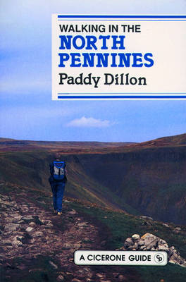
Walking in the North Pennines
Cicerone Press (Verlag)
978-1-85284-084-6 (ISBN)
- Titel erscheint in neuer Auflage
- Artikel merken
This work talks about the exhilarating walking in the area between the Yorkshire Dales and Hadrian's Wall. Wild moorland, beautiful riverside walks, woodlands, rich heritage - this uncrowded area has much to recommend it. The walks are a mixed bag, but they generally have a bias towards the wide-open moorlands and heights. This is what the North Pennines are all about - space, wilderness and exposure to the elements. There are a few easy, low-level walks suitable for the cautious or for use in nasty weather. Many of the higher routes aren't too difficult as they are routed along good clear tracks and paths. Levels of difficulty are given as easy, moderate or difficult. Most of the walks are circular and range from 4 to 13 miles. There are 42 day-walks in the guide, then a section of six longer walks presented in outline form only.
Paddy Dillon is a prolific outdoor writer with over thirty guidebooks to his name, as well as more than a dozen booklets and brochures. He writes for outdoor magazines and other publications, as well as for tourism organisations. Paddy lives near the Lake District and has walked in every county in England, Scotland, Ireland and Wales; writing about walks in every one of them. Paddy enjoys simple day walks, challenging long-distance walks, and is a dedicated island-hopper. He has led guided walks and walked extensively in Europe, as well as in Nepal, Tibet, Africa and the Rocky Mountains of Canada and the USA. While researching routes, Paddy works directly onto a palmtop computer, so that his descriptions are precise, having been written at the very point at which the reader uses them. Paddy takes his own photographs, has appeared on radio and TV, and is a member of the Outdoor Writers' Guild.
INTRODUCTION Geology The Whin Sill Scenery Weather The Helm Wind Flora Fauna Mining Grouse Shooting Access Public Transport The Walks Words on Maps Tourist Information Centres GELTSDALE SECTION Walk: 1.Brampton, Gelt and Talkin 2.Croglin and Croglin Fell 3.Midgeholme and Cold Fell SOUTH TYNEDALE SECTION 4.Slaggyford and Tom Smith's Stone 5.Alston and Garrigill 6.The Knockergill Pass EAST FELLSIDE SECTION 7.Black Fell and Renwick 8.Melmerby and Melmerby Fell 9.The Maiden Way 10.Blencarn and Cross Fell 11.Dufton and High Cup WARCOP RANGE SECTION 12.Murton, Murton Fell and Scordale 13.Hilton and Tinside Rigg 14.Mickle Fell STAINMORE SECTION 15.Stainmore Pass 16.North Stainmore and Slate Quarry Moss 17.Baldersdale and Cotherstone Moor 18.Bowes and the Pennine Way LOWER TEES SECTION 19.Barnard Castle and the Tees 20.Cotherstone and Romaldkirk 21.Hamsterley Forest MIDDLE TEES SECTION 22.Middleton and Monks Moor 23.Middleton and Grassholme 24.Middleton, Low Force and Bowlees UPPER TEES SECTION 25.Holwick, Cronkley Fell and High Force 26.Cauldron Snout and Widdybank Fell 27.Cow Green Reservoir and Herdship Fell WEARDALE SECTION 28.Wolsingham and Frosterley 29.Rookhope and Stanhope 30.Westgate and Middlehope Burn 31.St John's Chapel and Chapelfell Top DERWENTDALE SECTION 32.The Waskerley Way 33.Edmundbyers and Edmundbyers Common 34.Blanchland and Blanchland Moor 35.Devil's Water and Hangman Hill ALLENDALE SECTION 36.Allen Banks and Plankey Mill 37.Allendale Town and Hexhamshire Common 38.Allendale Town and the Allenmill Flue 39.Ninebanks and Hard Rigg DALEHEADS SECTION 40.Allenheads and Cowshill 41.Killhope Wheel and Killhope Law 42.Nenthead and Nag's Head LONG DISTANCE WALKS 1.The Pennine Way 2.The Weardale Way 3.The Teesdale Way 4.The Teesdale Watershed Walk 5.The Pennine Watershed Walk 6.Railway Rambling
| Erscheint lt. Verlag | 1.1.1991 |
|---|---|
| Zusatzinfo | Laminated Cover |
| Verlagsort | Kendal |
| Sprache | englisch |
| Maße | 116 x 172 mm |
| Themenwelt | Sachbuch/Ratgeber ► Sport |
| Reiseführer ► Europa ► Großbritannien | |
| ISBN-10 | 1-85284-084-6 / 1852840846 |
| ISBN-13 | 978-1-85284-084-6 / 9781852840846 |
| Zustand | Neuware |
| Haben Sie eine Frage zum Produkt? |
aus dem Bereich


