The Cleveland Way Map Booklet
Cicerone Press (Verlag)
978-1-78631-222-8 (ISBN)
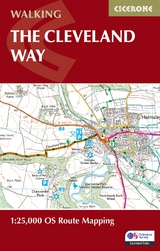
A booklet of all the mapping needed to complete the Cleveland Way National Trail between Helmsley and Filey. Covering 117km (110 miles) around the North York Moors National Park this straightforward hike takes around 1 week to walk.
The full route line is shown on 1:25K OS maps
The map booklet can be used to walk the trail in either direction
Sized to easily fit in a jacket pocket
The relevant extract from the OS Explorer map legend is included
An accompanying Cicerone guidebook – Walking the Cleveland Way and Yorkshire Wolds Way is also available, which includes a copy of this map booklet
Paddy Dillon is a prolific walker and guidebook writer, with over 100 guidebooks to his name and contributions to 40 other titles. He has written for several outdoor magazines and other publications and has appeared on radio and television. Paddy uses a tablet computer to write as he walks. His descriptions are therefore precise, having been written at the very point at which the reader uses them. Paddy is an indefatigable long-distance walker who has walked all of Britain's National Trails and several European trails. He has also walked in Nepal, China, Korea and the Rocky Mountains of Canada and the US. Paddy is a member of the Outdoor Writers and Photographers Guild and President of the Backpackers Club. www.paddydillon.co.uk
Contents
Key to map pages
Stage 1 Helmsley to Sutton Bank
Stage 2 Sutton Bank to Osmotherley
Stage 3 Osmotherley to Clay Bank
Stage 4 Clay Bank to Kildale
Stage 5 Kildale to Saltburn-by-the-Sea
Stage 6 Saltburn-by-the-Sea to Sandsend
Stage 7 Sandsend to Robin Hood's Bay
Stage 8 Robin Hood's Bay to Scarborough
Stage 9 Scarborough to Filey
OS Explorer map legend
| Erscheinungsdatum | 24.08.2024 |
|---|---|
| Reihe/Serie | Cicerone guidebooks |
| Verlagsort | Kendal |
| Sprache | englisch |
| Maße | 106 x 166 mm |
| Gewicht | 70 g |
| Themenwelt | Sachbuch/Ratgeber ► Sport |
| Reisen ► Karten / Stadtpläne / Atlanten ► Europa | |
| Reiseführer ► Europa ► Großbritannien | |
| Reisen ► Sport- / Aktivreisen | |
| ISBN-10 | 1-78631-222-0 / 1786312220 |
| ISBN-13 | 978-1-78631-222-8 / 9781786312228 |
| Zustand | Neuware |
| Haben Sie eine Frage zum Produkt? |
aus dem Bereich