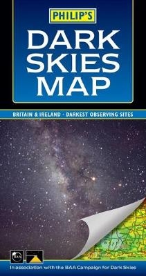
Philip's Dark Skies Map Britain and Ireland
Seiten
2004
Philip's (Verlag)
978-0-540-08612-2 (ISBN)
Philip's (Verlag)
978-0-540-08612-2 (ISBN)
- Titel ist leider vergriffen;
keine Neuauflage - Artikel merken
Shows the darkest locations in Britain and Ireland. Indicates the best and worst areas for observing. Indispensable for planning observing trips and holidays within Britain and Ireland. Accurate and detailed road mapping to guide you to your chosen observing site.
Philip's Dark Skies Map shows the visibility of stars from any location in Britain and Ireland. Stargazing can be frustrating where visibility is affected by street lights and other light pollution - use this map to find your nearest dark site or to avoid areas where light pollution will reduce your chances of seeing faint galaxies and other deep-sky objects. The underlying road mapping will allow you to plan a route to your chosen site.Philip's Dark Skies Map is published in association with the British Astronomical Association's Campaign for Dark Skies, an organization that campaigns to protect and improve our view of the night sky. The map has been created using data from the Light Pollution Science and Technology Institute in Italy, carefully combined with a Philip's road map (scale 20 miles to 1 inch). Different colours represent different levels of light pollution, and this information has been superimposed over the road map.
Philip's Dark Skies Map shows the visibility of stars from any location in Britain and Ireland. Stargazing can be frustrating where visibility is affected by street lights and other light pollution - use this map to find your nearest dark site or to avoid areas where light pollution will reduce your chances of seeing faint galaxies and other deep-sky objects. The underlying road mapping will allow you to plan a route to your chosen site.Philip's Dark Skies Map is published in association with the British Astronomical Association's Campaign for Dark Skies, an organization that campaigns to protect and improve our view of the night sky. The map has been created using data from the Light Pollution Science and Technology Institute in Italy, carefully combined with a Philip's road map (scale 20 miles to 1 inch). Different colours represent different levels of light pollution, and this information has been superimposed over the road map.
| Erscheint lt. Verlag | 20.9.2004 |
|---|---|
| Verlagsort | London |
| Sprache | englisch |
| Maße | 144 x 263 mm |
| Gewicht | 88 g |
| Themenwelt | Sachbuch/Ratgeber ► Natur / Technik ► Weltraum / Astronomie |
| ISBN-10 | 0-540-08612-6 / 0540086126 |
| ISBN-13 | 978-0-540-08612-2 / 9780540086122 |
| Zustand | Neuware |
| Haben Sie eine Frage zum Produkt? |
Mehr entdecken
aus dem Bereich
aus dem Bereich
die Suche nach der Urkraft des Universums
Buch | Hardcover (2023)
Klett-Cotta (Verlag)
25,00 €
Perspektiven auf die Menschheit
Buch | Hardcover (2024)
Klett-Cotta (Verlag)
25,00 €


