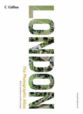
London
The Photographic Atlas
Seiten
2004
|
New edition
Collins (Verlag)
978-0-00-718435-4 (ISBN)
Collins (Verlag)
978-0-00-718435-4 (ISBN)
- Titel ist leider vergriffen;
keine Neuauflage - Artikel merken
'LONDON: The Photographic Atlas' offers higher-resolution images and superscale coverage of important tourist sites, Greater London is now revealed from the air in clarity and depth.
The widely-acclaimed 'LONDON: The Photographic Atlas' has now got even better. With higher-resolution images and superscale coverage of important tourist sites, Greater London is now revealed from the air in unparalleled clarity and unsurpassed depth. The first edition of 'LONDON: The Photographic Atlas' combined stunning aerial photography with world-class cartography to create an unbeatable image of one of the world's greatest cities. Now, with central London completely re-flown at a higher scale, the city is presented with breathtaking sharpness. If you live in Greater London, you will be able to find your house and perhaps even your car and explore new neighbourhoods with a clarity and immediacy that will astonish you. But the second edition of this best-selling book goes even further. An all-new 16 page superscale section swoops even closer into major landmarks than has ever been possible before. Magnificent London sights and buildings, such as Buckingham Palace, the Tower of London, the Houses of Parliament and Westminster Abbey are presented in a level of close-up coverage that is simply outstanding in its detail.
The London which the Photographic Atlas portrays is a living, changing mosaic. This new edition of the Photographic Atlas incorporates all the principal changes in the urban landscape since the last edition, showing the demolition of Wembley Stadium, all the changes in Docklands, and providing a visual catalogue of buildings which have sprung up, parks which have disappeared and much-loved vistas which have opened up or disappeared for ever. For Londoners and those who love the city, LONDON: the Photographic Atlas is a book of unique importance and stature.
Getmapping.com plc was established in 1998 specifically to produce the first ever complete, full-colour, digital, photographic map of the UK. The Millennium Map, as it is known, has revolutionised the market by making high-quality aerial photography widely available to both the professional user and the general public, primarily through its website, www.getmapping.com.
| Erscheint lt. Verlag | 6.9.2004 |
|---|---|
| Zusatzinfo | 300 col illus, (300 pages of aerial photography), With index |
| Verlagsort | London |
| Sprache | englisch |
| Maße | 270 x 366 mm |
| Gewicht | 3529 g |
| Themenwelt | Kunst / Musik / Theater ► Fotokunst |
| Sachbuch/Ratgeber ► Freizeit / Hobby ► Fotografieren / Filmen | |
| Reisen ► Karten / Stadtpläne / Atlanten ► Europa | |
| ISBN-10 | 0-00-718435-2 / 0007184352 |
| ISBN-13 | 978-0-00-718435-4 / 9780007184354 |
| Zustand | Neuware |
| Informationen gemäß Produktsicherheitsverordnung (GPSR) | |
| Haben Sie eine Frage zum Produkt? |
Mehr entdecken
aus dem Bereich
aus dem Bereich
Bilder machen, bearbeiten und verwalten mit Android-Handys und …
Buch | Softcover (2023)
dpunkt (Verlag)
24,90 €


