GPS for Mariners
McGraw-Hill Professional (Verlag)
978-0-07-141075-5 (ISBN)
- Titel erscheint in neuer Auflage
- Artikel merken
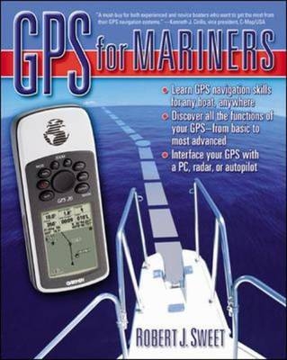
The manual you wish had come with your GPS receiver. "GPS for Mariners" summarizes essential global positioning system concepts, explains the buttons, screens, and menus of your GPS receiver, and answers all your questions. Filled with helpful illustrations and hands-on examples, this complete and practical guide shows you how to: become an informed GPS buyer and user; connect GPS to your computer, autopilot, and radar; navigate with GPS using waypoints and routes; use an electronic chartplotter or navigation software to plan and monitor your course; utilize the many functions in your GPS to safely and enjoyably reach your destination whether under sail or power; enhance your receiver's performance with WAAS, DGPS, and proper antenna placement; master advanced techniques.'A must-buy for both experienced and novice boaters who want to get the most from their GPS navigation systems' - Kenneth J. Cirillo, vice president, C-Map/USA. 'Great book! "GPS for Mariners" shows boaters how to use GPS with charts and even how to use digital charts for planning and navigating with your GPS' - Edward D. Markham, president, Maptech Inc.
'A must-read for anyone planning to navigate with GPS' - Robert P.David, past president, National Boating Federation, former national education officer, U.S. Power Squadrons.
Bob Sweet has more than 30 years of experience in the technology and electronics markets and 30 years of boating experience. He has held engineering and senior executive management positions with a number of companies including GTE, Harris, ABA Industries, Inframetrics and Elbit Systems - the last three at the President and CEO level. He has both BS and MS degrees in electrical engineering from Penn State. He started his career as a radar and communications system engineer and, throughout his career, gained extensive experience with GPS including managing a corporate business unit that developed major portions of GPS for the Air Force. More recently, Bob was instrumental in the boating education for the Power Squadrons in Southeastern New England. HOMETOWN: East Falmouth, MA
AcknowledgmentsHow to Navigate This Book Part 1. Using Your GPS ReceiverChapter 1. History and PerspectiveChapter 2. How GPS WorksThe Native Language of NavigationChapter 3. Your GPS ReceiverUsing Your GPS Receiver Start-Up: Simulation and Initialization Buttons, Screens, and Menus Data Entry and Options Selection Chapter 4. Using GPS to NavigateGPS and Electronic Navigation GPS Receiver Functions Other GPS Functions Chapter 5. GPS Receiver Selection and Cost ConsiderationsThe Handheld The Chartplotter Selecting a GPS Receiver Part 2. Advanced GPS TechniquesAdvanced Simulation Techniques Chapter 6. Using your GPS Receiver to Navigate with Charts and Local ObservationsRelating GPS to the Real World GPS Navigation Techniques Chapter 7. ChartplottingIntegrated Chartplotters Chartplotter Pages Selecting a Chartplotter Chartplotters Used with GPS Sensors Chartplotting Using a GPS Receiver Connected to a Computer Raster Versus Vector Charts The Future in Charts Chapter 8. Connecting your GPS Receiver to a ComputerWhat Is Required? Chapter 9. Navigating with GPS Receivers, Computers, and Other Equipment on Your BoatUsing GPS with a Computer while Afloat Chapter 10. Improving Performance and the Future of GPSGPS Receiver Accuracy DGPS and Sources of GPS Receiver Error WAAS Is GPS More Accurate than Charts? The Future of GPS Appendix1. Starting in the Simulator Mode2. Button Configurations for Popular GPS Handhelds3. Sample Exercise Using Waypoints and RoutesGlossaryResourcesIndex
| Erscheint lt. Verlag | 16.4.2003 |
|---|---|
| Zusatzinfo | 85 Illustrations, unspecified |
| Sprache | englisch |
| Maße | 183 x 229 mm |
| Gewicht | 353 g |
| Themenwelt | Sachbuch/Ratgeber ► Sport ► Segeln / Tauchen / Wassersport |
| Technik ► Fahrzeugbau / Schiffbau | |
| ISBN-10 | 0-07-141075-9 / 0071410759 |
| ISBN-13 | 978-0-07-141075-5 / 9780071410755 |
| Zustand | Neuware |
| Haben Sie eine Frage zum Produkt? |
aus dem Bereich


