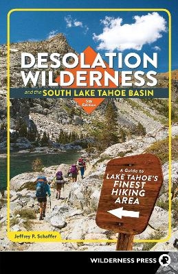
Desolation Wilderness and the South Lake Tahoe Basin
Wilderness Press (Verlag)
978-1-64359-065-3 (ISBN)
Your Guide to Northern California's Spectacular Hiking Area
Craggy mountain crests, dozens of hiking trails, and 130 lakes packed into 100 square miles of scenic beauty, Desolation Wilderness is one of the country's most popular wilderness areas. It is minutes from Lake Tahoe and just a few hours from Sacramento and San Francisco.
Explore the mountain landscape with hiking expert Jeffrey P. Schaffer. This comprehensive guide provides information on hiking, camping, wildlife, and natural history. It covers all of Desolation Wilderness, as well as Emerald Bay, the South Fork American River, and the Upper Truckee River. Written in cooperation with the federal Lake Tahoe Basin Management Unit, the guidebook has everything you need to plan your trip and to find your way in this unparalleled region.
Inside You'll Find
Descriptions of 32 hikes, divided into four areas
Table of mileages to 80 trout-stocked lakes
Details on the terrain, lakes, animals, and vegetation
Tips on when and where to get permits, and how to enjoy your hike with minimal environmental impact
A list of the area's campgrounds, arranged by trailhead locations
Full map of the region divided into seven sections
Jeffrey P. Schaffer made his first backpacking trip in a 1962 traverse of the Grand Canyon, at age 19. The following year the climbing frenzy seized him, which lasted until about 1972, some 200 roped ascents later. In that year he began working on his first book for Wilderness Press, The Pacific Crest Trail. Between then and the late 1980s, he was the sole or principal author of 12 guidebooks, and he had mapped about 4,000 miles of trail for his books and topographic maps. Innumerable observations while hiking made him question conventional geological wisdom on the origin of mountain ranges, which led him to write a lengthy book on the origin of the Sierra Nevada landscapes, particularly Yosemite Valley. At the start of the millennium he was teaching geology and geography at Napa Valley College, introducing students to the Sierra Nevada and other lands. Wilderness Press books authored or coauthored by Jeff include Hiker's Guide to the High Sierra: Yosemite and Tuolumne Meadows, Pacific Crest Trail: Southern California, Pacific Crest Trail: Northern California, The Pacific Crest Trail, Vol. 2: Oregon and Washington, Lassen Volcanic National Park and Vicinity, Yosemite National Park, Desolation Wilderness and the South Lake Tahoe Basin, The Tahoe Sierra, Hiking the Big Sur Country: The Ventana Wilderness, and The Geomorphic Evolution of the Yosemite Valley and Sierra Nevada Landscapes.
Chapter 1: The Country
Chapter 2: Hiking in the Tahoe Area
Chapter 3: Natural History of the Tahoe Area
Chapter 4: Thirty-Two Hikes
Desolation Wilderness, West Side
Hike 1: Loon Lake Trail
Hike 2: Lyons Creek Trail
Hike 3: Bloodsucker Lake Trail
Hike 4: Barrett Lake and Red Peak Trails
Hike 5: Twin Lakes and Grouse Lake Trails
Hike 6: Tyler Lake Trail
Hike 7: Rockbound Pass Trail
Hike 8: Horsetail Falls Trail
Hike 9: Ralston Peak Trail
Desolation Wilderness, Center
Hike 10: Pacific Crest Trail to Lake Aloha
Hike 11: Pacific Crest Trail to McKinney Creek OHV Staging Area
Desolation Wilderness, Southeast Side
Hike 12: Angora Fire Lookout and Angora Lakes
Hike 13: Tamarack Trail to Echo Peak
Hike 14: Grass Lake
Hike 15: Glen Alpine to Lake Aloha
Hike 16: Half Moon and Alta Morris Lakes
Hike 17: Mt. Tallac via Gilmore Lake
Hike 18: Mt. Tallac via Floating Island Lake
Hike 19: Granite Lake and Cascade Creek Fall
Hike 20: Velma Lakes Area
Emerald Bay
Hike 21: Emerald Bay State Park
Hike 22: D. L. Bliss State Park
Desolation Wilderness, Northeast Side and Sugar Pine Point State Park
Hike 23: Tahoe-Yosemite Trail to Middle Velma Lake
Hike 24: General Creek Trail
South Fork American River
Hike 25: Lovers Leap
Hike 26: Sayles Canyon and Bryan Meadow
Hike 27: Echo Summit to Showers Lake
Upper Truckee River
Hike 28: Hawley Grade Trail
Hike 29: Meiss Meadow Trail to Dardanelles Lake
Hike 30: Big Meadow Trail to Round Lake
Hike 31: Carson Pass to Showers Lake
Hike 32: Schneider's Cow Camp to Showers and Meiss Lakes
Chapter 5: Maps for Desolation Wilderness and Adjoining Areas
Recommended Reading and Source Materials
Index
Map Index
| Erscheinungsdatum | 10.05.2021 |
|---|---|
| Zusatzinfo | Black & white maps and photographs throughout |
| Sprache | englisch |
| Maße | 139 x 215 mm |
| Themenwelt | Sachbuch/Ratgeber ► Gesundheit / Leben / Psychologie |
| Sachbuch/Ratgeber ► Sport | |
| Reiseführer ► Nord- / Mittelamerika ► USA | |
| ISBN-10 | 1-64359-065-0 / 1643590650 |
| ISBN-13 | 978-1-64359-065-3 / 9781643590653 |
| Zustand | Neuware |
| Haben Sie eine Frage zum Produkt? |
aus dem Bereich


