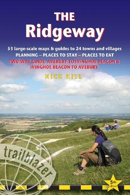
Ridgeway Trailblazer Walking Guide
Two-way guide: Avebury to Ivinghoe Beacon to Avebury
Seiten
2021
|
5th New edition
Trailblazer Publications (Verlag)
978-1-912716-20-3 (ISBN)
Trailblazer Publications (Verlag)
978-1-912716-20-3 (ISBN)
Zu diesem Artikel existiert eine Nachauflage
All the information you need to enjoy your hiking adventure along The Ridgeway is in this fully revised and updated 5th edition.
All-in-one guide to walking The Ridgeway path, running from Wiltshire to Buckinghamshire, in southern England. New two-way edition with routes rewalked in both directions from Avebury to Ivinghoe Beacon near Aylesbury and Ivinghoe Beacon to Avebury, and in two-colour style.
This guide includes:
Includes 53 detailed walking maps - the largest scale maps available - at just under 1:20,000 (8cm or 31/8 inches to one mile) these are bigger than even the most detailed walking maps currently available in the shops.
Unique mapping features – walking times, directions, tricky junctions, places to stay, places to eat, points of interest. These are not general-purpose maps but fully edited maps drawn by walkers for walkers.
Itineraries for all walkers – whether hiking the entire route or sampling highlights on day walks or short breaks.
Detailed public transport information for all access points.
Practical information for all budgets – what to see; where to eat (cafés, pubs and restaurants); where to stay (B&Bs, hotels, hostels, bunkhouses and campsites).
Downloadable GPS waypoints
| Erscheinungsdatum | 19.01.2021 |
|---|---|
| Verlagsort | Hindhead, Surrey |
| Sprache | englisch |
| Maße | 120 x 180 mm |
| Gewicht | 220 g |
| Themenwelt | Sachbuch/Ratgeber ► Sport |
| Reiseführer ► Europa ► Großbritannien | |
| ISBN-10 | 1-912716-20-8 / 1912716208 |
| ISBN-13 | 978-1-912716-20-3 / 9781912716203 |
| Zustand | Neuware |
| Haben Sie eine Frage zum Produkt? |
Mehr entdecken
aus dem Bereich
aus dem Bereich
individuell reisen mit vielen praktischen Tipps
Buch | Softcover (2024)
Michael Müller (Verlag)
29,90 €
Reiseführer mit Stadtplan, 4 Spaziergängen und kostenloser Web-App
Buch | Softcover (2023)
Reise Know-How (Verlag)
15,95 €


