


Map of the Inland Waterways of Great Britain
2001
Imray, Laurie, Norie & Wilson Ltd (Verlag)
978-0-85288-579-6 (ISBN)
Imray, Laurie, Norie & Wilson Ltd (Verlag)
978-0-85288-579-6 (ISBN)
- Titel erscheint in neuer Auflage
- Artikel merken
Zu diesem Artikel existiert eine Nachauflage
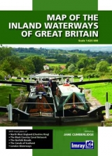
Clearly printed in full colour showing navigable and abandoned waterways with distances, this map has been completely revised and redrawn under the supervision of Jane Cumberlidge. It includes plans of North West England, The Cheshire Ring, Black Country Canals, the Norfolk Broads, the London Canal network and the small scale plan to show the Scottish Waterways. Imray's map has been standard reference to the Waterways system for nearly 50 years. Scale 1:6 2500, 28 x 40 fold-out map in cover.
| Erscheint lt. Verlag | 31.10.2001 |
|---|---|
| Zusatzinfo | Illustrations, unspecified |
| Verlagsort | Huntingdon |
| Sprache | englisch |
| Themenwelt | Sachbuch/Ratgeber ► Sport ► Segeln / Tauchen / Wassersport |
| Reisen ► Karten / Stadtpläne / Atlanten ► Europa | |
| ISBN-10 | 0-85288-579-2 / 0852885792 |
| ISBN-13 | 978-0-85288-579-6 / 9780852885796 |
| Zustand | Neuware |
| Haben Sie eine Frage zum Produkt? |
Mehr entdecken
aus dem Bereich


aus dem Bereich
wie ich meinem Traum folge und alleine durch die Ozeane der Welt …
Buch | Hardcover (2024)
Polyglott (Verlag)
22,99 €