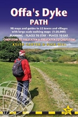
Offa's Dyke Path (Trailblazer British Walking Guides)
Chepstow To Prestatyn & Prestatyn To Chepstow, Planning, Places to Stay, Places to Eat, 98 large-scale maps & guides to 52 towns and villages (Trailblazer British Walking Guides)
Seiten
2019
|
5th Revised edition
Trailblazer Publications (Verlag)
978-1-912716-03-6 (ISBN)
Trailblazer Publications (Verlag)
978-1-912716-03-6 (ISBN)
- Titel erscheint in neuer Auflage
- Artikel merken
Zu diesem Artikel existiert eine Nachauflage
All-in-one, hiking route guide to 177-mile path following Offa's Dyke, the 8th century earthwork along the Wales/England border, with Two-Way directions, Chepstow to Prestatyn and Prestatyn to Chepstow. 98 large-scale maps; full details of all accommodations with reviews, and restaurants, pubs, teashops with reviews, public transport information.
The Offa's Dyke Path is a magnificent National Trail that runs from the North Wales coast to the Severn Estuary following the line of Offa's Dyke, an impressive 8th century earthwork along the English/Welsh border. The ever-changing landscape - the Wye Valley, the Black Mountains, the Shropshire Hills and the Clwydian Hills - is steeped in history and legend providing 177 miles of fascinating walking. This is the 5th edition. * New Two-Way edition, with directions both south to north and north to south * 98 walking maps - 1:20,000 (3-1/8 inches to 1 mile) - the largest-scale maps available. *Unique mapping features - walking times, directions, tricky junctions, places to stay, places to eat, points of interest. * Itineraries for all walkers - whether walking the route in its entirety or sampling the highlights on day walks and short breaks. * Practical information for all budgets - what to see, where to stay, where to eat: pubs, B&Bs, hotels, campsites, hostels. * Guides to 52 towns and villages - along the way * Public transport information - all access points on the path. * GPS waypoints. These are also downloadable from the Trailblazer website. * Includes extra colour sections: 16pp color introduction and 16pp of colour mapping for stage sections (one stage per page) with trail profiles.
The Offa's Dyke Path is a magnificent National Trail that runs from the North Wales coast to the Severn Estuary following the line of Offa's Dyke, an impressive 8th century earthwork along the English/Welsh border. The ever-changing landscape - the Wye Valley, the Black Mountains, the Shropshire Hills and the Clwydian Hills - is steeped in history and legend providing 177 miles of fascinating walking. This is the 5th edition. * New Two-Way edition, with directions both south to north and north to south * 98 walking maps - 1:20,000 (3-1/8 inches to 1 mile) - the largest-scale maps available. *Unique mapping features - walking times, directions, tricky junctions, places to stay, places to eat, points of interest. * Itineraries for all walkers - whether walking the route in its entirety or sampling the highlights on day walks and short breaks. * Practical information for all budgets - what to see, where to stay, where to eat: pubs, B&Bs, hotels, campsites, hostels. * Guides to 52 towns and villages - along the way * Public transport information - all access points on the path. * GPS waypoints. These are also downloadable from the Trailblazer website. * Includes extra colour sections: 16pp color introduction and 16pp of colour mapping for stage sections (one stage per page) with trail profiles.
Keith Carter has over 40 years' experience of hiking Britain's long-distance paths with numerous magazine articles published on the subject. He is also co-author of Trailblazer's Pennine Way (British Walking Guide in the same series). Joel Newton has updated this 5th edition. He is a keen outdoorsman, having completed most of Britains long-distance paths. He is the co-author with Henry Stedman of British Walking Guides from Trailblazer: Exmoor & North Devon Coast Path, Cornwall Coast Path and Dorset & South Devon Coast Path, and author of Thames Path.
| Erscheinungsdatum | 02.05.2019 |
|---|---|
| Reihe/Serie | Trailblazer British Walking Guides |
| Zusatzinfo | 30 colour photos; 3pp colour flower guide, maps: 87 b/w trail maps and 11 b/w town plans, 11 colour stage maps, 1 overview Offa's Dyke Path map |
| Verlagsort | Hindhead, Surrey |
| Sprache | englisch |
| Maße | 120 x 180 mm |
| Gewicht | 248 g |
| Themenwelt | Sachbuch/Ratgeber ► Sport |
| Reiseführer ► Europa ► Großbritannien | |
| ISBN-10 | 1-912716-03-8 / 1912716038 |
| ISBN-13 | 978-1-912716-03-6 / 9781912716036 |
| Zustand | Neuware |
| Informationen gemäß Produktsicherheitsverordnung (GPSR) | |
| Haben Sie eine Frage zum Produkt? |
Mehr entdecken
aus dem Bereich
aus dem Bereich
Geschichten, Geheimnisse und anderes cooles Zeug
Buch | Softcover (2024)
MAIRDUMONT (Verlag)
17,95 €


