Pennine Way
Trailblazer Publications (Verlag)
978-1-912716-02-9 (ISBN)
- Titel erscheint in neuer Auflage
- Artikel merken
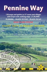
Britain's best-known National Trail winds for 256 miles through three National Parks - the Peak District, Yorkshire Dales and Northumberland. This is the 5th edition. This superb footpath showcases Britain's finest upland scenery, while touching the literary landscape of the Bronte family and Roman history along Hadrian's Wall. *138 large-scale walking maps - at just under 1:20,000 - showing route times, gradients, where to stay, interesting features.*Guides to 57 towns and villages - along the way*Itineraries for all walkers - whether walking the route in its entirety or sampling the highlights on day walks and short breaks.*Practical information for all budgets - Edale to Kirk Yetholm: where to stay with reviews (B&Bs, hostels, campsites, pubs and hotels), where to eat with reviews, what to see, plus detailed town plans*Public transport information - all access points on the path.*GPS waypoints. These are also downloadable from the Trailblazer website.*Now includes extra colour sections: 16pp colour introduction and 16pp of colour mapping for stage sections (one stage per page) with trail profiles.
The first edition was written by Edward de la Billiere and Keith Carter, with additional information by Charlie Loram. Keith has over 40 years' experience of hiking Britain's long-distance paths with numerous magazine articles published on the subject. He has also written for Trailblazer's British Walking Guides series: Offa's Dyke Path. Henry Stedman updated this 5th edition. Henry has been writing guidebooks for almost a quarter of a century and is the author of: Kilimanjaro, the Trekking Guide, Coast to Coast Path, Hadrian's Wall Path, Dales Way, North Downs Way 2nd ed, and co-author with Joel Newton of all three books in the South-West-Coast- Path series. He's also updated Offa's Dyke Path, Pembrokeshire Coast Path, South Downs Way and The Ridgeway.
| Erscheinungsdatum | 15.05.2019 |
|---|---|
| Reihe/Serie | Trailblazer British Walking Guides |
| Zusatzinfo | 138 trail maps (3 1/8 inches to 1 mile), 60 colour photos, town plans, and 15 stage maps + 2 overview |
| Verlagsort | Hindhead, Surrey |
| Sprache | englisch |
| Maße | 120 x 180 mm |
| Gewicht | 314 g |
| Themenwelt | Sachbuch/Ratgeber ► Sport |
| Reiseführer ► Europa ► Großbritannien | |
| ISBN-10 | 1-912716-02-X / 191271602X |
| ISBN-13 | 978-1-912716-02-9 / 9781912716029 |
| Zustand | Neuware |
| Informationen gemäß Produktsicherheitsverordnung (GPSR) | |
| Haben Sie eine Frage zum Produkt? |
aus dem Bereich


